Area Overview for GU9 8TQ
Photos of GU9 8TQ
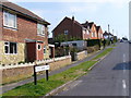
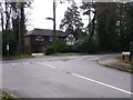
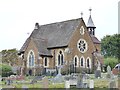
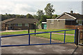
24 photos from this area
Area Information
Key information about the GU9 8TQ including its size, population, and administrative classification.
- Area Type
- Postcode
- Area Size
- 3.5 hectares
- Population
- 1374
- Population Density
- 2971 people/km²
House Prices in GU9 8TQ
44
Properties
£302,773
Average Sold Price
£69,950
Lowest Price
£675,000
Highest Price
Showing 44 properties
| Address | Type | Beds | Baths | Last Sale Price | Last Sale Date | |
|---|---|---|---|---|---|---|
| 112 Greenfield Road, Farnham, GU9 8TQ | Semi-detached | 3 | 1 | £550,000 | Jan 2024 | |
| 72 Greenfield Road, Farnham, GU9 8TQ | Semi-detached | 3 | 1 | £440,000 | Oct 2023 | |
| 85 Greenfield Road, Farnham, GU9 8TQ | Semi-detached | 2 | 1 | £335,200 | May 2023 | |
| 83 Greenfield Road, Farnham, GU9 8TQ | Semi-detached | 2 | - | £367,500 | Feb 2022 | |
| 80 Greenfield Road, Farnham, GU9 8TQ | house | - | - | £310,000 | Nov 2020 | |
| 67 Greenfield Road, Farnham, GU9 8TQ | house | - | - | £368,000 | Aug 2020 | |
| 77 Greenfield Road, Farnham, GU9 8TQ | Semi-detached | 3 | 2 | £341,000 | Jul 2020 | |
| 71 Greenfield Road, Farnham, GU9 8TQ | Semi-detached | 3 | 2 | £398,000 | Dec 2019 | |
| 75 Greenfield Road, Farnham, GU9 8TQ | Semi-detached | 3 | 1 | £345,000 | Apr 2019 | |
| 122 Greenfield Road, Farnham, GU9 8TQ | Semi-detached | 3 | - | £325,000 | Mar 2019 |
Page 1 of 5
Energy Efficiency in GU9 8TQ
Amenities
Schools
| Rank | School | Type | Entry gender | Ages |
|---|
Explore more schools in this area
Go to Schools tabDemographics
Household Size
Family (3-5 people)
most common
Accommodation Type
Houses
most common
Tenure
84
majority
Ethnic Group
White
most common
Religion
N/A
most common
Household Composition
N/A
most common
Age
47
median
Adults (30-64 years)
most common
Household Deprivation
N/A
with no deprivation
NS-SEC
49
in Lower managerial occupations
Explore more demographic insights in this area
Go to Demographics tabPlanning
Planning Constraints
- Flood RiskPremium
- Ramsar Wetland SitesPremium
- Area of Outstanding Natural BeautyPremium
- Protected Nature ReservePremium
- Protected WoodlandPremium