Area Overview for GU9 8SH
Photos of GU9 8SH
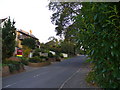
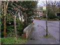
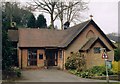
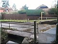
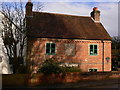
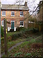
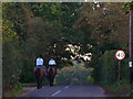
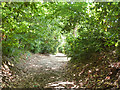
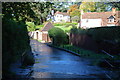
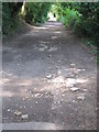
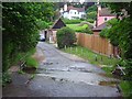
11 photos from this area
Area Information
Key information about the GU9 8SH including its size, population, and administrative classification.
- Area Type
- Postcode
- Area Size
- 2.1 hectares
- Population
- 1374
- Population Density
- 2971 people/km²
House Prices in GU9 8SH
28
Properties
£524,688
Average Sold Price
£149,000
Lowest Price
£825,000
Highest Price
Showing 28 properties
| Address | Type | Beds | Baths | Last Sale Price | Last Sale Date | |
|---|---|---|---|---|---|---|
| 59 Shortheath Road, Farnham, GU9 8SH | Semi-detached | 3 | 1 | £650,000 | Jul 2023 | |
| 53 Shortheath Road, Farnham, GU9 8SH | house | - | - | £439,000 | Sep 2021 | |
| 49 Shortheath Road, Farnham, GU9 8SH | house | 2 | - | £475,000 | Oct 2020 | |
| 45 Shortheath Road, Farnham, GU9 8SH | house | - | - | £500,000 | Dec 2018 | |
| Tudor House, 61 Shortheath Road, Farnham, GU9 8SH | Detached | 4 | 2 | £825,000 | May 2018 | |
| 55 Shortheath Road, Farnham, GU9 8SH | house | - | - | £737,000 | Nov 2017 | |
| 33A Shortheath Road, Farnham, GU9 8SH | house | - | - | £750,000 | Aug 2017 | |
| Rowans, Shortheath Road, Farnham, GU9 8SH | Bungalow | - | - | £690,000 | Apr 2017 | |
| 47 Shortheath Road, Farnham, GU9 8SH | house | 2 | 1 | £350,000 | Mar 2015 | |
| 39 Shortheath Road, Farnham, GU9 8SH | Detached | 4 | - | £665,000 | Jul 2014 |
Page 1 of 3
Energy Efficiency in GU9 8SH
Amenities
Schools
| Rank | School | Type | Entry gender | Ages |
|---|
Explore more schools in this area
Go to Schools tabDemographics
Household Size
Family (3-5 people)
most common
Accommodation Type
Houses
most common
Tenure
84
majority
Ethnic Group
White
most common
Religion
N/A
most common
Household Composition
N/A
most common
Age
47
median
Adults (30-64 years)
most common
Household Deprivation
N/A
with no deprivation
NS-SEC
49
in Lower managerial occupations
Explore more demographic insights in this area
Go to Demographics tabPlanning
Planning Constraints
- Flood RiskPremium
- Ramsar Wetland SitesPremium
- Area of Outstanding Natural BeautyPremium
- Protected Nature ReservePremium
- Protected WoodlandPremium