Area Overview for GU9 8RH
Photos of GU9 8RH
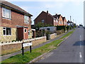
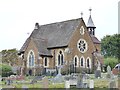
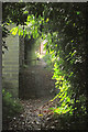
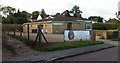
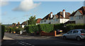
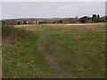
24 photos from this area
Area Information
Key information about the GU9 8RH including its size, population, and administrative classification.
- Area Type
- Postcode
- Area Size
- 1.7 hectares
- Population
- 1313
- Population Density
- 5271 people/km²
House Prices in GU9 8RH
38
Properties
£293,070
Average Sold Price
£68,500
Lowest Price
£526,500
Highest Price
Showing 38 properties
| Address | Type | Beds | Baths | Last Sale Price | Last Sale Date | |
|---|---|---|---|---|---|---|
| 69 Baldreys, Farnham, GU9 8RH | Terraced | 2 | 1 | £420,000 | Jul 2023 | |
| 30 Baldreys, Farnham, GU9 8RH | house | - | - | £526,500 | Jan 2023 | |
| 51 Baldreys, Farnham, GU9 8RH | Semi-detached | 3 | 1 | £350,000 | Mar 2020 | |
| 49 Baldreys, Farnham, GU9 8RH | Semi-detached | 3 | 1 | £345,000 | May 2019 | |
| 71 Baldreys, Farnham, GU9 8RH | Semi-detached | 3 | 1 | £375,000 | Apr 2019 | |
| 39 Baldreys, Farnham, GU9 8RH | Semi-detached | 5 | 1 | £345,000 | Jun 2018 | |
| 44 Baldreys, Farnham, GU9 8RH | Semi-detached | 3 | 1 | £335,000 | Dec 2016 | |
| 77 Baldreys, Farnham, GU9 8RH | Semi-detached | 3 | 1 | £392,450 | Aug 2016 | |
| 41 Baldreys, Farnham, GU9 8RH | house | - | - | £325,000 | Sep 2015 | |
| 34 Baldreys, Farnham, GU9 8RH | Semi-detached | 4 | 1 | £340,000 | Jul 2015 |
Page 1 of 4
Energy Efficiency in GU9 8RH
Amenities
Schools
| Rank | School | Type | Entry gender | Ages |
|---|
Explore more schools in this area
Go to Schools tabDemographics
Household Size
Family (3-5 people)
most common
Accommodation Type
Houses
most common
Tenure
54
majority
Ethnic Group
White
most common
Religion
N/A
most common
Household Composition
N/A
most common
Age
47
median
Adults (30-64 years)
most common
Household Deprivation
N/A
with no deprivation
NS-SEC
33
in Lower managerial occupations
Explore more demographic insights in this area
Go to Demographics tabPlanning
Planning Constraints
- Flood RiskPremium
- Ramsar Wetland SitesPremium
- Area of Outstanding Natural BeautyPremium
- Protected Nature ReservePremium
- Protected WoodlandPremium