Area Overview for GU9 8LW
Photos of GU9 8LW
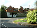
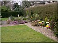
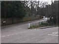
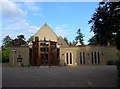
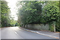
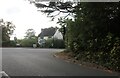
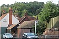
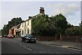
38 photos from this area
Area Information
Key information about the GU9 8LW including its size, population, and administrative classification.
- Area Type
- Postcode
- Area Size
- 1.6 hectares
- Population
- 1452
- Population Density
- 91025 people/km²
House Prices in GU9 8LW
11
Properties
£686,056
Average Sold Price
£329,000
Lowest Price
£995,000
Highest Price
Showing 11 properties
| Address | Type | Beds | Baths | Last Sale Price | Last Sale Date | |
|---|---|---|---|---|---|---|
| 68 Firgrove Hill, Farnham, GU9 8LW | Detached | 5 | 3 | £899,950 | Feb 2018 | |
| 76 Firgrove Hill, Farnham, GU9 8LW | house | - | - | £995,000 | Jul 2017 | |
| 66 Firgrove Hill, Farnham, GU9 8LW | house | 4 | - | £830,000 | Aug 2012 | |
| 74 Firgrove Hill, Farnham, GU9 8LW | Detached | 5 | - | £737,000 | Dec 2010 | |
| 80 Firgrove Hill, Farnham, GU9 8LW | Detached | - | - | £575,000 | Mar 2007 | |
| Sandmere, 72 Firgrove Hill, Farnham, GU9 8LW | Detached | - | - | £622,500 | Aug 2006 | |
| 78 Firgrove Hill, Farnham, GU9 8LW | house | - | - | £500,000 | Jul 2001 | |
| 82 Firgrove Hill, Farnham, GU9 8LW | Detached | - | - | £329,000 | Oct 1999 | |
| 70 Firgrove Hill, Farnham, GU9 8LW | Detached | - | - | - | - | |
| 74A Firgrove Hill, Farnham, GU9 8LW | Detached | - | - | - | - |
Page 1 of 2
Energy Efficiency in GU9 8LW
Amenities
Schools
| Rank | School | Type | Entry gender | Ages |
|---|
Explore more schools in this area
Go to Schools tabDemographics
Household Size
Family (3-5 people)
most common
Accommodation Type
Houses
most common
Tenure
86
majority
Ethnic Group
White
most common
Religion
N/A
most common
Household Composition
N/A
most common
Age
47
median
Adults (30-64 years)
most common
Household Deprivation
N/A
with no deprivation
NS-SEC
58
in Lower managerial occupations
Explore more demographic insights in this area
Go to Demographics tabPlanning
Planning Constraints
- Flood RiskPremium
- Ramsar Wetland SitesPremium
- Area of Outstanding Natural BeautyPremium
- Protected Nature ReservePremium
- Protected WoodlandPremium