Area Overview for GU9 8DN
Photos of GU9 8DN

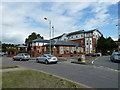
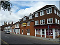
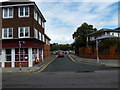
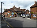


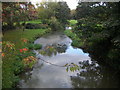

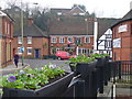

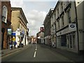
100 photos from this area
Area Information
Key information about the GU9 8DN including its size, population, and administrative classification.
- Area Type
- Postcode
- Area Size
- 7216 m²
- Population
- 1664
- Population Density
- 2987 people/km²
House Prices in GU9 8DN
11
Properties
£830,299
Average Sold Price
£300,000
Lowest Price
£1,210,000
Highest Price
Showing 11 properties
| Address | Type | Beds | Baths | Last Sale Price | Last Sale Date | |
|---|---|---|---|---|---|---|
| 57 Tilford Road, Farnham, GU9 8DN | Retail | 4 | 3 | £1,000,000 | Mar 2025 | |
| 45 Tilford Road, Farnham, GU9 8DN | Detached | 4 | 2 | £1,210,000 | Jun 2024 | |
| 53 Tilford Road, Farnham, GU9 8DN | Semi-detached | 4 | 3 | £980,000 | May 2022 | |
| 39 Tilford Road, Farnham, GU9 8DN | Detached | 4 | 2 | £925,000 | Sep 2020 | |
| 41 Tilford Road, Farnham, GU9 8DN | Detached | 3 | 1 | £566,791 | Jul 2013 | |
| 47 Tilford Road, Farnham, GU9 8DN | Detached | - | - | £300,000 | Jul 1998 | |
| 55 Tilford Road, Farnham, GU9 8DN | Semi-detached | 4 | 3 | - | - | |
| Winton, 49 Tilford Road, Farnham, GU9 8DN | Detached | - | - | - | - | |
| 51 Tilford Road, Farnham, GU9 8DN | Bungalow | - | - | - | - | |
| 43 Tilford Road, Farnham, GU9 8DN | Detached | - | - | - | - |
Page 1 of 2
Energy Efficiency in GU9 8DN
Amenities
Schools
| Rank | School | Type | Entry gender | Ages |
|---|
Explore more schools in this area
Go to Schools tabDemographics
Household Size
Family (3-5 people)
most common
Accommodation Type
Houses
most common
Tenure
70
majority
Ethnic Group
White
most common
Religion
N/A
most common
Household Composition
N/A
most common
Age
47
median
Adults (30-64 years)
most common
Household Deprivation
N/A
with no deprivation
NS-SEC
57
in Lower managerial occupations
Explore more demographic insights in this area
Go to Demographics tabPlanning
Planning Constraints
- Flood RiskPremium
- Ramsar Wetland SitesPremium
- Area of Outstanding Natural BeautyPremium
- Protected Nature ReservePremium
- Protected WoodlandPremium