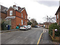
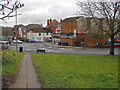
Area Overview for GU9 7UT
Photos of GU9 7UT


Area Information
Living in GU9 7UT offers a quiet, residential lifestyle in a small cluster of homes nestled in southern England. With a population of just over 1,600, this area feels intimate, avoiding the congestion of larger towns while remaining within reach of key services. The postcode sits in a region where traditional housing dominates, with most properties being family homes. Daily life here is shaped by proximity to Farnham, a nearby town offering shops, rail links, and cultural amenities. Commuters benefit from multiple railway stations within practical distance, including Farnham and Aldershot, linking the area to broader networks. The low crime risk and absence of environmental constraints like protected woodlands or wetlands make it an appealing choice for those seeking stability. While the population is modest, the area’s small size fosters a sense of community, with local amenities such as Lidl and M&S providing everyday conveniences. For those prioritising safety, the area’s scores for flood risk and crime are reassuring. GU9 7UT is ideal for buyers seeking a balance between tranquillity and accessibility, with homes that reflect the character of the surrounding region.
- Area Type
- Postcode
- Area Size
- Not available
- Population
- 1611
- Population Density
- 3733 people/km²
The property market in GU9 7UT is characterised by a predominance of houses, with 44% of residents owning their homes. This suggests a mix of owner-occupied properties and rental units, though the small population and limited area size mean the housing stock is not extensive. The focus on houses rather than flats or apartments indicates a traditional, family-oriented market. Buyers considering this area should note that the small scale of GU9 7UT means properties are likely to be in close proximity to one another, with limited scope for new developments. The home ownership rate of 44% implies that a significant portion of the housing is rented, which could influence availability and competition for buyers. For those seeking a quiet, residential environment, the area’s proximity to Farnham and its rail links may be a draw, though the limited number of properties means buyers should act promptly. The market is likely to cater to those prioritising stability and low crime risk over rapid capital growth.
House Prices in GU9 7UT
No properties found in this postcode.
Energy Efficiency in GU9 7UT
Life in GU9 7UT is shaped by its proximity to retail, dining, and transport hubs. Within practical reach are notable venues such as Lidl Farnham, Cook Farnham, and M&S Farnham BP, offering everyday shopping and dining options. The area’s rail network, with stations like Farnham and Aldershot, provides easy access to larger towns, enabling residents to enjoy cultural and leisure activities beyond the immediate postcode. The nearby Farnborough Airport adds to the area’s appeal for those requiring travel flexibility. While GU9 7UT itself is small, its location ensures residents are not isolated from amenities. The presence of multiple retail outlets and transport links contributes to a convenient, low-stress lifestyle. For families, the lack of major planning constraints or environmental restrictions means the area is free from the complexities of protected sites or strict development rules. This combination of local convenience and regional accessibility makes GU9 7UT a practical choice for those seeking a balanced, everyday life.
Amenities
Schools
| Rank | School | Type | Entry gender | Ages |
|---|
Explore more schools in this area
Go to Schools tabDemographics
The community in GU9 7UT is predominantly middle-aged, with a median age of 47 and the largest age group being adults aged 30–64. This suggests a population largely in their prime working and family-raising years, which may influence local services and amenities. Home ownership stands at 44%, indicating a mix of owner-occupied properties and rental units. The accommodation type is primarily houses, which aligns with the area’s small, residential nature. The predominant ethnic group is White, reflecting broader regional trends. While no specific data on deprivation is provided, the low crime risk and absence of planning constraints suggest a stable, low-pressure environment. This demographic profile implies a community focused on practical living, with fewer young families or retirees compared to other areas. The age distribution and ownership rates suggest a balance between long-term residents and those seeking a quieter lifestyle, though the relatively low home ownership rate may indicate some reliance on rental markets or shared housing.
Household Size
Accommodation Type
Tenure
Ethnic Group
Religion
Household Composition
Age
Household Deprivation
NS-SEC
Explore more demographic insights in this area
Go to Demographics tabPlanning
Planning Constraints
- Flood RiskPremium
- Ramsar Wetland SitesPremium
- Area of Outstanding Natural BeautyPremium
- Protected Nature ReservePremium
- Protected WoodlandPremium