Area Overview for GU9 7NT
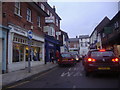
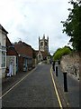
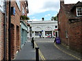
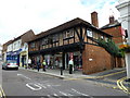
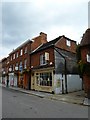
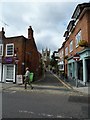
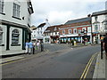
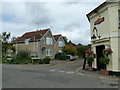
Photos of GU9 7NT


Area Information
Living in GU9 7NT offers a compact, residential experience shaped by its small cluster of homes and proximity to key services. With a population of 1,753 and a density of 1,065 people per square kilometre, the area is tightly knit, fostering a sense of community. The median age of 47 suggests a mature demographic, with adults aged 30–64 forming the majority. This is a place where stability is evident, reflected in the 51% home ownership rate and the prevalence of flats. The area’s charm lies in its accessibility: nearby railway stations at Farnham, Aldershot, and Bentley provide swift links to larger towns, while Sainsburys, Waitrose, and local shops in Farnham cater to daily needs. For families, the mix of primary schools and the University for the Creative Arts adds a layer of educational diversity. Though small, GU9 7NT balances practicality with the quiet rhythm of suburban life, making it appealing for those seeking a manageable, connected environment without the sprawl of bigger cities.
- Area Type
- Postcode
- Area Size
- Not available
- Population
- 1753
- Population Density
- 1065 people/km²
The property market in GU9 7NT is characterised by a 51% home ownership rate, with flats being the predominant accommodation type. This suggests a rental market that is active but not dominant, as nearly half of properties are owner-occupied. The prevalence of flats indicates a focus on smaller, more manageable homes, which may appeal to buyers seeking affordability or ease of maintenance. Given the area’s small size and high density, the housing stock is likely to be limited in variety, with fewer detached properties or larger family homes. For buyers, this means competition for available units, particularly in the flat market. The proximity to Farnham’s amenities and transport links may enhance the area’s appeal, though the compact nature of GU9 7NT means that properties are likely to be in close proximity to one another. Investors should consider the balance between rental demand and the potential for long-term value in a stable, mature community.
House Prices in GU9 7NT
No properties found in this postcode.
Energy Efficiency in GU9 7NT
Life in GU9 7NT is shaped by its proximity to Farnham’s amenities, including Sainsburys, Waitrose, and Cook, which provide a range of retail and grocery options. The nearby railway stations offer access to larger towns, while Farnborough Airport adds flexibility for regional travel. The area’s compact nature means that essential services are within walking or short driving distance, fostering a convenient lifestyle. Parks and open spaces are not explicitly mentioned in the data, but the absence of protected natural areas suggests that leisure options may be limited to local parks or nearby green spaces in Farnham. The presence of the University for the Creative Arts adds a cultural dimension, potentially offering events or facilities for residents. For those prioritising convenience and connectivity, GU9 7NT’s blend of retail, transport, and educational resources makes it a practical choice, though its small size may require residents to venture further for more extensive leisure opportunities.
Amenities
Schools
GU9 7NT is served by a range of educational institutions, including St Andrew’s CofE Controlled Infant School, a primary school, and St Andrew’s Church of England Infant School, which is an academy with a ‘good’ Ofsted rating. The presence of two primary schools suggests a focus on early education, while the University for the Creative Arts adds a higher education dimension. The mix of school types provides families with options, from traditional state schools to specialist institutions. The ‘good’ rating at St Andrew’s Church of England Infant School indicates a reliable standard of teaching, though the data does not specify performance metrics for the other schools. For parents, the proximity to these schools reduces commuting time, enhancing the area’s appeal. However, the absence of secondary schools in the immediate vicinity may require families to look further afield for comprehensive education.
| Rank | School | Type | Entry gender | Ages |
|---|
Explore more schools in this area
Go to Schools tabDemographics
The community in GU9 7NT is predominantly composed of adults aged 30–64, with a median age of 47. This suggests a mature, settled population, likely with established careers and families. Home ownership stands at 51%, indicating a mix of owner-occupied and rental properties. The accommodation type is largely flats, which aligns with the area’s compact nature and density. The predominant ethnic group is White, though specific diversity metrics are not provided. The high population density of 1,065 people per square kilometre implies a closely packed residential layout, which may influence the pace of daily life. While the data does not specify deprivation levels, the demographic profile suggests a community focused on stability and practical living. The age range and home ownership figures indicate a population that values long-term residency and community ties, with fewer transient residents compared to younger or more transient areas.
Household Size
Accommodation Type
Tenure
Ethnic Group
Religion
Household Composition
Age
Household Deprivation
NS-SEC
Explore more demographic insights in this area
Go to Demographics tabPlanning
Planning Constraints
- Flood RiskPremium
- Ramsar Wetland SitesPremium
- Area of Outstanding Natural BeautyPremium
- Protected Nature ReservePremium
- Protected WoodlandPremium