Area Overview for GU9 7BG
Photos of GU9 7BG
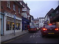
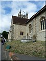
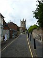
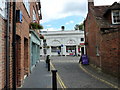
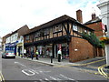
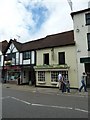
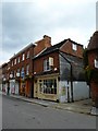
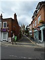
100 photos from this area
Area Information
Key information about the GU9 7BG including its size, population, and administrative classification.
- Area Type
- Postcode
- Area Size
- 1.5 hectares
- Population
- 1406
- Population Density
- 236 people/km²
House Prices in GU9 7BG
23
Properties
£527,882
Average Sold Price
£110,000
Lowest Price
£1,569,750
Highest Price
Showing 23 properties
| Address | Type | Beds | Baths | Last Sale Price | Last Sale Date | |
|---|---|---|---|---|---|---|
| 29 Crondall Lane, Farnham, GU9 7BG | Detached | 4 | 2 | £806,630 | Apr 2025 | |
| 19 Crondall Lane, Farnham, GU9 7BG | house | - | - | £655,000 | Jan 2025 | |
| Bredon, 45A Crondall Lane, Farnham, GU9 7BG | Bungalow | 4 | 1 | £715,000 | Nov 2024 | |
| Hillberry, 21 Crondall Lane, Farnham, GU9 7BG | Semi-detached | 3 | 1 | £775,000 | Aug 2022 | |
| 43 Crondall Lane, Farnham, GU9 7BG | Bungalow | 3 | 2 | £1,569,750 | Jun 2022 | |
| 11 Crondall Lane, Farnham, GU9 7BG | Semi-detached | 4 | - | £687,500 | Dec 2020 | |
| 33 Crondall Lane, Farnham, GU9 7BG | Detached | 4 | 1 | £730,000 | May 2018 | |
| 39 Crondall Lane, Farnham, GU9 7BG | Semi-detached | 3 | 1 | £300,000 | Jan 2014 | |
| 37 Crondall Lane, Farnham, GU9 7BG | house | - | - | £285,000 | Aug 2012 | |
| 43A Crondall Lane, Farnham, GU9 7BG | house | 3 | - | £430,000 | Sep 2011 |
Page 1 of 3
Energy Efficiency in GU9 7BG
Amenities
Schools
| Rank | School | Type | Entry gender | Ages |
|---|
Explore more schools in this area
Go to Schools tabDemographics
Household Size
Two person
most common
Accommodation Type
Houses
most common
Tenure
79
majority
Ethnic Group
White
most common
Religion
N/A
most common
Household Composition
N/A
most common
Age
47
median
Adults (30-64 years)
most common
Household Deprivation
N/A
with no deprivation
NS-SEC
47
in Lower managerial occupations
Explore more demographic insights in this area
Go to Demographics tabPlanning
Planning Constraints
- Flood RiskPremium
- Ramsar Wetland SitesPremium
- Area of Outstanding Natural BeautyPremium
- Protected Nature ReservePremium
- Protected WoodlandPremium