Area Overview for GU8 6LF
Photos of GU8 6LF


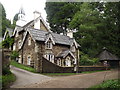
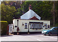

19 photos from this area
Area Information
Key information about the GU8 6LF including its size, population, and administrative classification.
- Area Type
- Postcode
- Area Size
- 75.4 hectares
- Population
- 1149
- Population Density
- 138 people/km²
House Prices in GU8 6LF
10
Properties
£1,257,500
Average Sold Price
£865,000
Lowest Price
£1,650,000
Highest Price
Showing 10 properties
| Address | Type | Beds | Baths | Last Sale Price | Last Sale Date | |
|---|---|---|---|---|---|---|
| Holt Cottage, Seale Road, Elstead, Godalming, GU8 6LF | house | - | - | £865,000 | Mar 2025 | |
| Speedwell, Seale Road, Elstead, Godalming, GU8 6LF | Bungalow | - | - | £1,650,000 | Jul 2013 | |
| Stables, Turners Farm, Seale Road, Elstead, Godalming, GU8 6LF | Equestrian | - | - | - | - | |
| Three Barrows, Seale Road, Elstead, Godalming, GU8 6LF | Detached | - | - | - | - | |
| Tennis 76M From The Holt Cottage, Seale Road 39M From Seale Road, Seale Road, Elstead, Godalming, GU8 6LF | Leisure | - | - | - | - | |
| The Barrows, Seale Road, Elstead, Godalming, GU8 6LF | Detached | - | - | - | - | |
| Turners Farm, Seale Road, Elstead, Godalming, GU8 6LF | Detached | - | - | - | - | |
| The Gatehouse, Three Barrows, Seale Road, Elstead, Godalming, GU8 6LF | Detached | - | - | - | - | |
| The Lodge, Three Barrows, Seale Road, Elstead, Godalming, GU8 6LF | Detached | - | - | - | - | |
| Holt House, Seale Road, Elstead, Godalming, GU8 6LF | house | - | - | - | - |
Energy Efficiency in GU8 6LF
Amenities
Schools
| Rank | School | Type | Entry gender | Ages |
|---|
Explore more schools in this area
Go to Schools tabDemographics
Household Size
One person
most common
Accommodation Type
Houses
most common
Tenure
61
majority
Ethnic Group
White
most common
Religion
N/A
most common
Household Composition
N/A
most common
Age
47
median
Adults (30-64 years)
most common
Household Deprivation
N/A
with no deprivation
NS-SEC
39
in Lower managerial occupations
Explore more demographic insights in this area
Go to Demographics tabPlanning
Planning Constraints
- Flood RiskPremium
- Ramsar Wetland SitesPremium
- Area of Outstanding Natural BeautyPremium
- Protected Nature ReservePremium
- Protected WoodlandPremium