Area Overview for GU8 4TS
Photos of GU8 4TS
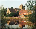
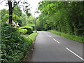
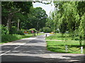
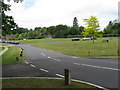
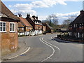
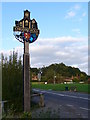
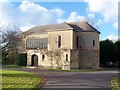
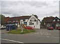
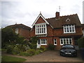
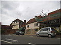
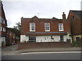
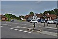
82 photos from this area
Area Information
Key information about the GU8 4TS including its size, population, and administrative classification.
- Area Type
- Postcode
- Area Size
- 42.7 hectares
- Population
- 1550
- Population Density
- 57 people/km²
House Prices in GU8 4TS
25
Properties
£1,085,150
Average Sold Price
£360,000
Lowest Price
£2,400,000
Highest Price
Showing 25 properties
| Address | Type | Beds | Baths | Last Sale Price | Last Sale Date | |
|---|---|---|---|---|---|---|
| Tower House, Pickhurst Road, Chiddingfold, Godalming, GU8 4TS | Detached | 5 | 3 | £1,825,000 | Aug 2024 | |
| Okelands Cottage, Pickhurst Road, Chiddingfold, Godalming, GU8 4TS | Cottage | 2 | 1 | £900,000 | Jan 2024 | |
| Nuthurst Cottage, Pickhurst Road, Chiddingfold, Godalming, GU8 4TS | house | - | - | £1,000,000 | Nov 2019 | |
| Hazelbridge Cottage, Pickhurst Road, Chiddingfold, Godalming, GU8 4TS | Bungalow | - | - | £1,300,000 | Apr 2019 | |
| April Cottage, Pickhurst Road, Chiddingfold, Godalming, GU8 4TS | house | - | - | £722,500 | Jan 2017 | |
| Crosstrees, Pickhurst Road, Chiddingfold, Godalming, GU8 4TS | house | - | - | £944,000 | Nov 2012 | |
| Hazelbridge House, Pickhurst Road, Chiddingfold, Godalming, GU8 4TS | house | - | - | £2,400,000 | Feb 2010 | |
| Marden Well, Pickhurst Road, Chiddingfold, Godalming, GU8 4TS | Detached | - | - | £550,000 | Oct 2005 | |
| Ridge Cottage, Pickhurst Road, Chiddingfold, Godalming, GU8 4TS | Detached | - | - | £360,000 | Nov 2000 | |
| Park House, Pickhurst Road, Chiddingfold, Godalming, GU8 4TS | Detached | 5 | 5 | £850,000 | Mar 1997 |
Page 1 of 3
Energy Efficiency in GU8 4TS
Amenities
Schools
| Rank | School | Type | Entry gender | Ages |
|---|
Explore more schools in this area
Go to Schools tabDemographics
Household Size
Two person
most common
Accommodation Type
Houses
most common
Tenure
75
majority
Ethnic Group
White
most common
Religion
N/A
most common
Household Composition
N/A
most common
Age
47
median
Adults (30-64 years)
most common
Household Deprivation
N/A
with no deprivation
NS-SEC
46
in Lower managerial occupations
Explore more demographic insights in this area
Go to Demographics tabPlanning
Planning Constraints
- Flood RiskPremium
- Ramsar Wetland SitesPremium
- Area of Outstanding Natural BeautyPremium
- Protected Nature ReservePremium
- Protected WoodlandPremium