Area Overview for GU8 4SL
Photos of GU8 4SL
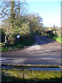
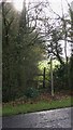
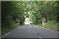
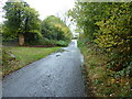

14 photos from this area
Area Information
Key information about the GU8 4SL including its size, population, and administrative classification.
- Area Type
- Postcode
- Area Size
- 1.4 km²
- Population
- 1192
- Population Density
- 80 people/km²
House Prices in GU8 4SL
22
Properties
£1,323,500
Average Sold Price
£387,500
Lowest Price
£2,700,000
Highest Price
Showing 22 properties
| Address | Type | Beds | Baths | Last Sale Price | Last Sale Date | |
|---|---|---|---|---|---|---|
| Cherfold Cottage, Petworth Road, Chiddingfold, Godalming, GU8 4SL | Lodge | 2 | 1 | £1,100,000 | May 2021 | |
| Fairfield, Petworth Road, Chiddingfold, Godalming, GU8 4SL | Detached | - | - | £2,700,000 | Sep 2019 | |
| Old Cherfold, Petworth Road, Chiddingfold, Godalming, GU8 4SL | house | 5 | - | £1,180,000 | Oct 2017 | |
| Russets, Petworth Road, Chiddingfold, Godalming, GU8 4SL | Detached | 1 | - | £1,250,000 | Nov 2009 | |
| Winterfields, Petworth Road, Chiddingfold, Godalming, GU8 4SL | Detached | - | - | £387,500 | Apr 2007 | |
| The Cabin, Mill House Farm, Petworth Road, Chiddingfold, Godalming, GU8 4SL | Detached | 6 | 3 | - | - | |
| Millhouse Cottage, Petworth Road, Chiddingfold, Godalming, GU8 4SL | Bungalow | 2 | 2 | - | - | |
| Mill House, Petworth Road, Chiddingfold, Godalming, GU8 4SL | Bungalow | 2 | 2 | - | - | |
| Flat, Russets, Petworth Road, Chiddingfold, Godalming, GU8 4SL | Detached | 4 | - | - | - | |
| Cowdray Estates Ltd, Chiddingfold Golf Club, Petworth Road, Chiddingfold, Godalming, GU8 4SL | house | - | - | - | - |
Page 1 of 3
Energy Efficiency in GU8 4SL
Amenities
Schools
| Rank | School | Type | Entry gender | Ages |
|---|
Explore more schools in this area
Go to Schools tabDemographics
Household Size
Family (3-5 people)
most common
Accommodation Type
Houses
most common
Tenure
69
majority
Ethnic Group
White
most common
Religion
N/A
most common
Household Composition
N/A
most common
Age
47
median
Adults (30-64 years)
most common
Household Deprivation
N/A
with no deprivation
NS-SEC
47
in Lower managerial occupations
Explore more demographic insights in this area
Go to Demographics tabPlanning
Planning Constraints
- Flood RiskPremium
- Ramsar Wetland SitesPremium
- Area of Outstanding Natural BeautyPremium
- Protected Nature ReservePremium
- Protected WoodlandPremium