Area Overview for GU8 4RY
Photos of GU8 4RY
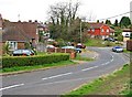


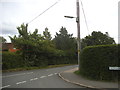
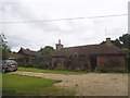


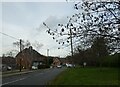

71 photos from this area
Area Information
Key information about the GU8 4RY including its size, population, and administrative classification.
- Area Type
- Postcode
- Area Size
- 1.3 hectares
- Population
- 1317
- Population Density
- 583 people/km²
House Prices in GU8 4RY
20
Properties
£565,946
Average Sold Price
£117,750
Lowest Price
£775,000
Highest Price
Showing 20 properties
| Address | Type | Beds | Baths | Last Sale Price | Last Sale Date | |
|---|---|---|---|---|---|---|
| 13 Ash Combe, Chiddingfold, Godalming, GU8 4RY | Semi-detached | 4 | 3 | £755,000 | Jun 2025 | |
| 21 Ash Combe, Chiddingfold, Godalming, GU8 4RY | Semi-detached | 5 | 2 | £743,000 | Aug 2023 | |
| 19 Ash Combe, Chiddingfold, Godalming, GU8 4RY | Detached | 3 | 1 | £748,000 | May 2023 | |
| 2 Ash Combe, Chiddingfold, Godalming, GU8 4RY | Retail | 5 | 2 | £775,000 | May 2022 | |
| 1 Ash Combe, Chiddingfold, Godalming, GU8 4RY | Retail | 3 | 1 | £720,000 | May 2022 | |
| 11 Ash Combe, Chiddingfold, Godalming, GU8 4RY | Detached | 5 | 2 | £600,000 | Feb 2021 | |
| 14 Ash Combe, Chiddingfold, Godalming, GU8 4RY | Detached | 4 | 2 | £657,000 | Jun 2019 | |
| 23 Ash Combe, Chiddingfold, Godalming, GU8 4RY | Semi-detached | 4 | 1 | £490,000 | Jan 2017 | |
| 8 Ash Combe, Chiddingfold, Godalming, GU8 4RY | house | - | - | £469,950 | Oct 2014 | |
| 9 Ash Combe, Chiddingfold, Godalming, GU8 4RY | house | 5 | - | £589,500 | Oct 2012 |
Page 1 of 2
Energy Efficiency in GU8 4RY
Amenities
Schools
| Rank | School | Type | Entry gender | Ages |
|---|
Explore more schools in this area
Go to Schools tabDemographics
Household Size
Family (3-5 people)
most common
Accommodation Type
Houses
most common
Tenure
84
majority
Ethnic Group
White
most common
Religion
N/A
most common
Household Composition
N/A
most common
Age
47
median
Adults (30-64 years)
most common
Household Deprivation
N/A
with no deprivation
NS-SEC
53
in Lower managerial occupations
Explore more demographic insights in this area
Go to Demographics tabPlanning
Planning Constraints
- Flood RiskPremium
- Ramsar Wetland SitesPremium
- Area of Outstanding Natural BeautyPremium
- Protected Nature ReservePremium
- Protected WoodlandPremium