Area Overview for GU8 4LA
Photos of GU8 4LA
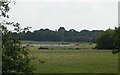
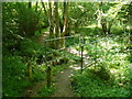
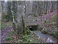
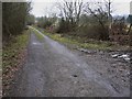
34 photos from this area
Area Information
Key information about the GU8 4LA including its size, population, and administrative classification.
- Area Type
- Postcode
- Area Size
- 53.8 hectares
- Population
- 1550
- Population Density
- 57 people/km²
House Prices in GU8 4LA
16
Properties
£855,000
Average Sold Price
£350,000
Lowest Price
£1,425,000
Highest Price
Showing 16 properties
| Address | Type | Beds | Baths | Last Sale Price | Last Sale Date | |
|---|---|---|---|---|---|---|
| Elmbridge House, The Common, Dunsfold, Godalming, GU8 4LA | Detached | 4 | 3 | £1,425,000 | Jul 2023 | |
| Springfield House, The Common, Dunsfold, Godalming, GU8 4LA | Detached | 5 | 3 | £1,200,000 | Sep 2022 | |
| Bayfield Stud, The Common, Dunsfold, Godalming, GU8 4LA | Detached | 4 | 2 | £1,250,000 | Feb 2022 | |
| Pantiles, The Common, Dunsfold, Godalming, GU8 4LA | Bungalow | - | - | £680,000 | May 2021 | |
| Martins Cottage, The Common, Dunsfold, Godalming, GU8 4LA | house | - | - | £765,000 | Apr 2016 | |
| Bridge House, The Common, Dunsfold, Godalming, GU8 4LA | Detached | - | - | £670,000 | Mar 2010 | |
| Mendips, The Common, Dunsfold, Godalming, GU8 4LA | Detached | - | - | £760,000 | Aug 2009 | |
| Quiet Meadow, The Common, Dunsfold, Godalming, GU8 4LA | Detached | - | - | £595,000 | Dec 2006 | |
| Noddings, The Common, Dunsfold, Godalming, GU8 4LA | Detached | - | - | £350,000 | Dec 2005 | |
| Pound Farm, The Common, Dunsfold, Godalming, GU8 4LA | Detached | 6 | 2 | - | - |
Page 1 of 2
Energy Efficiency in GU8 4LA
Amenities
Schools
| Rank | School | Type | Entry gender | Ages |
|---|
Explore more schools in this area
Go to Schools tabDemographics
Household Size
Two person
most common
Accommodation Type
Houses
most common
Tenure
75
majority
Ethnic Group
White
most common
Religion
N/A
most common
Household Composition
N/A
most common
Age
47
median
Adults (30-64 years)
most common
Household Deprivation
N/A
with no deprivation
NS-SEC
46
in Lower managerial occupations
Explore more demographic insights in this area
Go to Demographics tabPlanning
Planning Constraints
- Flood RiskPremium
- Ramsar Wetland SitesPremium
- Area of Outstanding Natural BeautyPremium
- Protected Nature ReservePremium
- Protected WoodlandPremium