Area Overview for GU7 3PR
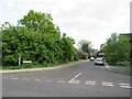
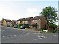
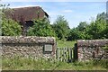
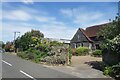
Photos of GU7 3PR


Area Information
Living in GU7 3PR means being part of a tightly knit residential cluster in England, where 1,336 people reside across just 1,083 square metres. This compact area, with a population density of over 1.2 million per square kilometre, reflects a mature community characterised by established homes and a strong local identity. The median age of 47 suggests a population skewed toward adults aged 30–64, indicating a stable, family-oriented environment. Daily life here is shaped by proximity to essential services, with rail stations and retail hubs within practical reach. The area’s small size fosters a sense of familiarity, though its density means space is limited. For those seeking a quiet, low-maintenance lifestyle with access to nearby amenities, GU7 3PR offers a blend of practicality and community focus, supported by low crime rates and minimal environmental risks.
- Area Type
- Postcode
- Area Size
- 1083 m²
- Population
- 1336
- Population Density
- 2822 people/km²
GU7 3PR’s property market is defined by a 58% home ownership rate, indicating a balance between owner-occupied homes and rental properties. The accommodation type is primarily houses, which suggests a focus on family-friendly, standalone dwellings rather than apartments or flats. Given the area’s small size and high population density, the housing stock is likely limited, with properties concentrated in a compact cluster. For buyers, this means competition for available homes, particularly in a market where demand may outstrip supply. The predominance of houses also implies that the area caters to households requiring more space, though the high density may mean proximity to neighbours. Prospective buyers should consider the area’s immediate surroundings for additional options, as the small postcode may not offer extensive variety.
House Prices in GU7 3PR
Showing 1 properties
| Address | Type | Beds | Baths | Last Sale Price | Last Sale Date | |
|---|---|---|---|---|---|---|
| Borg Pharma Ltd, Binscombe Pharmacy, 106 Binscombe, Godalming, GU7 3PR | commercial | - | - | - | - |
Energy Efficiency in GU7 3PR
The lifestyle in GU7 3PR is shaped by its proximity to practical amenities, including five rail stations and five retail outlets. Nearby shops such as Co-op Farncombe and Waitrose Godalming offer everyday essentials, while the rail network provides easy access to surrounding areas. Although the data does not specify parks or leisure facilities, the area’s compact size suggests a focus on local services rather than expansive recreational spaces. Residents benefit from a straightforward, no-frills lifestyle, with amenities concentrated within walking or short driving distance. This setup caters to those who value convenience over sprawling landscapes, though it may lack the extensive leisure options found in larger towns. The character of daily life here is defined by accessibility and the efficiency of nearby services.
Amenities
Schools
Residents of GU7 3PR have access to three primary schools: Green Lane Infant School, Binscombe Junior School, and Loseley Fields Primary School, which holds an Ofsted rating of ‘good’. These institutions provide a range of educational options for young children, with two primary schools catering to different age groups. The presence of multiple primary schools within proximity is a significant advantage for families, reducing the need for long commutes. However, no secondary schools are listed in the data, so parents may need to look further afield for secondary education. The ‘good’ rating at Loseley Fields indicates a reliable standard of teaching, though the overall quality of the other schools remains unspecified. This mix of options supports a practical approach to schooling for local families.
| Rank | School | Type | Entry gender | Ages |
|---|
Explore more schools in this area
Go to Schools tabDemographics
The community in GU7 3PR is predominantly composed of adults aged 30–64, with a median age of 47. Home ownership stands at 58%, reflecting a mix of owner-occupied properties and rental units. The area is dominated by houses rather than flats, aligning with its residential character. The predominant ethnic group is White, though no specific diversity metrics are provided. With a population density of 1,233,665 people per square kilometre, the area is exceptionally compact, which may influence living conditions and community dynamics. This density, combined with the age profile, suggests a stable, long-term resident base. However, the high concentration of people in a small space could impact local infrastructure and services, though the data does not indicate current strain.
Household Size
Accommodation Type
Tenure
Ethnic Group
Religion
Household Composition
Age
Household Deprivation
NS-SEC
Explore more demographic insights in this area
Go to Demographics tabPlanning
Planning Constraints
- Flood RiskPremium
- Ramsar Wetland SitesPremium
- Area of Outstanding Natural BeautyPremium
- Protected Nature ReservePremium
- Protected WoodlandPremium