Area Overview for GU7 2QH
Photos of GU7 2QH
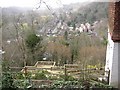

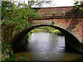


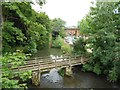
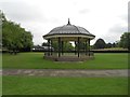


100 photos from this area
Area Information
Key information about the GU7 2QH including its size, population, and administrative classification.
- Area Type
- Postcode
- Area Size
- 44.5 hectares
- Population
- 1420
- Population Density
- 1576 people/km²
House Prices in GU7 2QH
22
Properties
£870,400
Average Sold Price
£445,000
Lowest Price
£1,482,000
Highest Price
Showing 22 properties
| Address | Type | Beds | Baths | Last Sale Price | Last Sale Date | |
|---|---|---|---|---|---|---|
| Westhanger Place, Westbrook Road, Godalming, GU7 2QH | Detached | - | - | £950,000 | Oct 2022 | |
| Melrose, Westbrook Road, Godalming, GU7 2QH | Semi-detached | 2 | 2 | £480,000 | Jul 2018 | |
| Westhanger Court, Westbrook Road, Godalming, GU7 2QH | house | - | - | £995,000 | Jun 2017 | |
| Little Russet, Westbrook Road, Godalming, GU7 2QH | house | - | - | £445,000 | Aug 2009 | |
| Westaway Cottage, Westbrook Road, Godalming, GU7 2QH | Bungalow | 8 | 5 | £1,482,000 | Sep 1998 | |
| Shepherds Cottage, Westbrook Road, Godalming, GU7 2QH | Semi-detached | 3 | 1 | - | - | |
| Far Cottage, Westbrook Road, Godalming, GU7 2QH | Retail | 3 | 2 | - | - | |
| Westbrook, Westbrook Road, Godalming, GU7 2QH | Detached | 4 | 3 | - | - | |
| Ockford Wood Farm, New Way, Godalming, GU7 2QH | Detached | 5 | 2 | - | - | |
| The Meath Trustee Company Ltd, The Meath, Westbrook Road, Godalming, GU7 2QH | Retirement | - | - | - | - |
Page 1 of 3
Energy Efficiency in GU7 2QH
Amenities
Schools
| Rank | School | Type | Entry gender | Ages |
|---|
Explore more schools in this area
Go to Schools tabDemographics
Household Size
Family (3-5 people)
most common
Accommodation Type
Houses
most common
Tenure
50
majority
Ethnic Group
White
most common
Religion
N/A
most common
Household Composition
N/A
most common
Age
47
median
Adults (30-64 years)
most common
Household Deprivation
N/A
with no deprivation
NS-SEC
36
in Lower managerial occupations
Explore more demographic insights in this area
Go to Demographics tabPlanning
Planning Constraints
- Flood RiskPremium
- Ramsar Wetland SitesPremium
- Area of Outstanding Natural BeautyPremium
- Protected Nature ReservePremium
- Protected WoodlandPremium