Area Overview for GU7 2EF
Photos of GU7 2EF
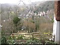


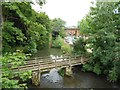


100 photos from this area
Area Information
Key information about the GU7 2EF including its size, population, and administrative classification.
- Area Type
- Postcode
- Area Size
- 3921 m²
- Population
- 1174
- Population Density
- 1345 people/km²
House Prices in GU7 2EF
14
Properties
£318,909
Average Sold Price
£168,000
Lowest Price
£430,000
Highest Price
Showing 14 properties
| Address | Type | Beds | Baths | Last Sale Price | Last Sale Date | |
|---|---|---|---|---|---|---|
| 12, Sol Y Vista, Frith Hill Road, Godalming, GU7 2EF | Maisonette | 2 | 1 | £420,000 | May 2025 | |
| 13, Sol Y Vista, Frith Hill Road, Godalming, GU7 2EF | Terraced | 2 | 1 | £310,000 | Oct 2023 | |
| 9, Sol Y Vista, Frith Hill Road, Godalming, GU7 2EF | Maisonette | 2 | 1 | £430,000 | Jan 2023 | |
| 1, Sol Y Vista, Frith Hill Road, Godalming, GU7 2EF | Maisonette | - | - | £386,000 | Mar 2021 | |
| 6, Sol Y Vista, Frith Hill Road, Godalming, GU7 2EF | Maisonette | - | - | £367,500 | Mar 2021 | |
| 14, Sol Y Vista, Frith Hill Road, Godalming, GU7 2EF | Maisonette | - | - | £420,000 | Jan 2021 | |
| 10, Sol Y Vista, Frith Hill Road, Godalming, GU7 2EF | Maisonette | - | - | £242,500 | Sep 2010 | |
| 2, Sol Y Vista, Frith Hill Road, Godalming, GU7 2EF | Terraced | 2 | 1 | £317,500 | Feb 2008 | |
| 5, Sol Y Vista, Frith Hill Road, Godalming, GU7 2EF | Maisonette | 3 | 2 | £208,000 | Jul 2005 | |
| 3, Sol Y Vista, Frith Hill Road, Godalming, GU7 2EF | house | 2 | 1 | £238,500 | Jan 2004 |
Page 1 of 2
Energy Efficiency in GU7 2EF
Amenities
Schools
| Rank | School | Type | Entry gender | Ages |
|---|
Explore more schools in this area
Go to Schools tabDemographics
Household Size
Two person
most common
Accommodation Type
Flats
most common
Tenure
62
majority
Ethnic Group
White
most common
Religion
N/A
most common
Household Composition
N/A
most common
Age
47
median
Adults (30-64 years)
most common
Household Deprivation
N/A
with no deprivation
NS-SEC
58
in Lower managerial occupations
Explore more demographic insights in this area
Go to Demographics tabPlanning
Planning Constraints
- Flood RiskPremium
- Ramsar Wetland SitesPremium
- Area of Outstanding Natural BeautyPremium
- Protected Nature ReservePremium
- Protected WoodlandPremium