Area Overview for GU7 1ST
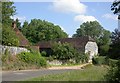
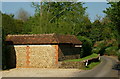
Photos of GU7 1ST


Area Information
Living in GU7 1ST offers a compact, residential experience in a small cluster of homes. The area covers 10.4 hectares, housing 1,692 people in a densely populated setting with 16,339 residents per square kilometre. This suggests a tightly knit community where proximity to amenities and services is a key feature. The area’s demographic profile is dominated by adults aged 30–64, with a median age of 47, indicating a stable, established population. Home ownership is high at 89%, reflecting a preference for long-term residency. Nearby, the Godalming College sixth-form provides educational opportunities, while rail stations like Milford and Godalming offer easy access to wider transport networks. Retail options such as Tesco Milford and Waitrose Godalming cater to daily needs, reinforcing the area’s convenience. For those seeking a balance between residential tranquillity and practical connectivity, GU7 1ST presents a focused, community-oriented environment.
- Area Type
- Postcode
- Area Size
- 10.4 hectares
- Population
- 1692
- Population Density
- 1891 people/km²
The property market in GU7 1ST is defined by high home ownership, with 89% of residents living in owner-occupied homes. This indicates a stable, long-term demographic, with limited rental activity. The accommodation type is predominantly houses, which is unusual for a small postcode area but suggests a focus on family-sized properties. The compact size of the area—just 10.4 hectares—means the housing stock is limited, which could make the market competitive for buyers. Given the high population density, properties are likely to be closely spaced, with little scope for expansion. For prospective buyers, this suggests a need to act swiftly, as the small number of available homes may be quickly absorbed by existing residents. The predominance of houses also implies that the area may cater to those seeking traditional family homes rather than flats or apartments.
House Prices in GU7 1ST
Showing 1 properties
| Address | Type | Beds | Baths | Last Sale Price | Last Sale Date | |
|---|---|---|---|---|---|---|
| Ladywell Convent, Ashstead Lane, Godalming, GU7 1ST | residential_space | - | - | - | - |
Energy Efficiency in GU7 1ST
The lifestyle in GU7 1ST is shaped by its proximity to essential amenities. Retail options like Tesco Milford and Waitrose Godalming provide access to groceries and other goods, while nearby rail stations offer direct links to broader transport networks. The area’s compact size means that these services are likely within walking or cycling distance, promoting a convenient, low-maintenance lifestyle. However, the data does not mention parks, leisure facilities, or dining options, so it is unclear whether the area offers recreational spaces or a variety of restaurants. The focus on retail and transport suggests a practical, service-oriented daily life, but residents may need to travel further for more diverse leisure activities. The high population density also implies a close-knit community, where social interactions may be more frequent due to the proximity of homes and services.
Amenities
Schools
The nearest educational institution to GU7 1ST is Godalming College, a sixth-form college. This suggests that the area is likely to attract families with older children, particularly those seeking post-16 education. However, the absence of primary or secondary schools in the data means that families with younger children may need to look further afield for schooling options. The presence of a sixth-form college indicates a focus on higher education and vocational training, which could be a draw for those prioritising post-secondary opportunities. For parents, the lack of local primary schools may necessitate reliance on nearby towns for younger children’s education. The data does not provide Ofsted ratings or additional details about the college, so further research would be needed to assess its academic standards.
| Rank | School | Type | Entry gender | Ages |
|---|
Explore more schools in this area
Go to Schools tabDemographics
GU7 1ST is characterised by a mature population, with a median age of 47 and the majority of residents falling within the 30–64 age range. This suggests a community of established individuals, likely with strong ties to the area. Home ownership is exceptionally high at 89%, indicating a preference for long-term investment in property. The accommodation type is predominantly houses, aligning with the area’s residential focus. The predominant ethnic group is White, reflecting a homogenous demographic profile. The population density of 16,339 per square kilometre is exceptionally high, which may influence the character of daily life, fostering a sense of closeness among residents. This density also means that amenities and services are likely within walking distance, though it may contribute to a more compact, less sprawling living environment. The data does not indicate significant deprivation, suggesting that quality of life is maintained through accessible infrastructure and services.
Household Size
Accommodation Type
Tenure
Ethnic Group
Religion
Household Composition
Age
Household Deprivation
NS-SEC
Explore more demographic insights in this area
Go to Demographics tabPlanning
Planning Constraints
- Flood RiskPremium
- Ramsar Wetland SitesPremium
- Area of Outstanding Natural BeautyPremium
- Protected Nature ReservePremium
- Protected WoodlandPremium