Area Overview for GU7 1RS
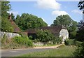
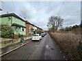
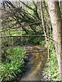
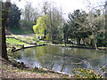
Photos of GU7 1RS


Area Information
Living in GU7 1RS offers a compact, densely populated residential cluster in England, covering just 1.3 hectares yet housing 1,692 people. The area’s high population density of 128,654 people per square kilometre reflects a tightly knit community. Daily life here is shaped by proximity to amenities and transport links, with residents enjoying easy access to retail hubs, rail stations, and educational institutions. The area’s small size means a strong sense of local identity, though its limited space may feel constrained for those seeking expansive outdoor spaces. Despite its density, the area is characterised by low crime risk, with a safety score of 97, suggesting a secure environment. The absence of environmental constraints like protected woodlands or AONB designations means fewer restrictions on development, though this also means fewer natural landscapes to explore. For buyers, GU7 1RS presents a mix of practicality and convenience, with homes primarily in private ownership and a focus on proximity to essential services.
- Area Type
- Postcode
- Area Size
- 1.3 hectares
- Population
- 1692
- Population Density
- 1891 people/km²
GU7 1RS is a predominantly owner-occupied area, with 89% of homes in private hands, indicating a community of long-term residents rather than a rental market. The accommodation type is exclusively houses, which is unusual for a small postcode area but suggests a focus on single-family living. This makes the area attractive to buyers seeking traditional homes with private gardens, though the limited space of 1.3 hectares means housing is tightly packed. The high home ownership rate implies strong local demand, but the small size of the area means property choices are limited. Buyers should consider proximity to amenities and transport, as the area’s value is tied to its connectivity rather than expansive land. The lack of flats or apartments also means it may not suit those seeking more affordable or flexible housing options.
House Prices in GU7 1RS
No properties found in this postcode.
Energy Efficiency in GU7 1RS
Residents of GU7 1RS have access to a range of amenities within walking or short driving distance. Retail options include major supermarkets such as Cook Godalming, Waitrose Godalming, and Sainsburys Godalming, ensuring convenience for grocery shopping and daily needs. The area’s rail network, with stations like Godalming and Milford, connects residents to broader transport links, supporting both commuting and leisure travel. While the data does not mention parks or leisure facilities, the absence of environmental constraints like protected woodlands or AONB designations suggests limited natural spaces. However, the compact layout and proximity to retail and transport hubs create a lifestyle focused on practicality and accessibility, ideal for those prioritising convenience over expansive outdoor recreation.
Amenities
Schools
The nearest educational institution to GU7 1RS is Godalming College, a sixth-form college offering post-16 education. Notably, Godalming College is listed twice in the data, though this may reflect redundancy rather than two distinct institutions. The absence of primary or secondary schools in the area means families with younger children would need to look further afield for schooling. For those requiring higher education, the proximity to Godalming College is a clear advantage, though it does not provide comprehensive schooling for all age groups. This makes the area more suitable for households with teenagers or adults pursuing further education, rather than families requiring a full range of school options.
| Rank | School | Type | Entry gender | Ages |
|---|---|---|---|---|
| 1 | Godalming College | sixth-form | N/A | N/A |
| 2 | Godalming College | sixth-form | N/A | N/A |
Explore more schools in this area
Go to Schools tabDemographics
The community in GU7 1RS is predominantly middle-aged, with a median age of 47 and the majority of residents falling within the 30–64 age range. Home ownership is exceptionally high at 89%, indicating a stable, long-term resident base. The area is composed almost entirely of houses, reflecting a traditional housing stock rather than flats or apartments. The predominant ethnic group is White, though no specific diversity statistics are provided. The high home ownership rate and age profile suggest a community focused on family stability and long-term residence. With 1,692 people in such a small area, social networks are likely close-knit, though the density may limit opportunities for larger family homes. The absence of detailed deprivation data means the area’s quality of life is inferred from its safety and connectivity, which appear strong.
Household Size
Accommodation Type
Tenure
Ethnic Group
Religion
Household Composition
Age
Household Deprivation
NS-SEC
Explore more demographic insights in this area
Go to Demographics tabPlanning
Planning Constraints
- Flood RiskPremium
- Ramsar Wetland SitesPremium
- Area of Outstanding Natural BeautyPremium
- Protected Nature ReservePremium
- Protected WoodlandPremium
- Crime RiskPremium