Area Overview for GU6 8UG
Photos of GU6 8UG
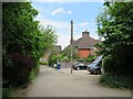
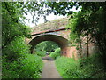
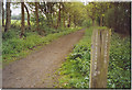
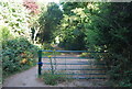
36 photos from this area
Area Information
Key information about the GU6 8UG including its size, population, and administrative classification.
- Area Type
- Postcode
- Area Size
- 1.1 hectares
- Population
- 1733
- Population Density
- 613 people/km²
House Prices in GU6 8UG
32
Properties
£212,719
Average Sold Price
£40,000
Lowest Price
£435,000
Highest Price
Showing 32 properties
| Address | Type | Beds | Baths | Last Sale Price | Last Sale Date | |
|---|---|---|---|---|---|---|
| 39 Elm Park, Cranleigh, GU6 8UG | Terraced | 1 | 1 | £270,000 | May 2024 | |
| 45 Elm Park, Cranleigh, GU6 8UG | Semi-detached | 2 | 1 | £335,000 | Feb 2024 | |
| 6 Elm Park, Cranleigh, GU6 8UG | Terraced | 2 | 1 | £308,500 | Dec 2023 | |
| 23 Elm Park, Cranleigh, GU6 8UG | Maisonette | 1 | 1 | £185,000 | Sep 2023 | |
| 19 Elm Park, Cranleigh, GU6 8UG | Flat | - | - | £119,000 | Aug 2022 | |
| 7 Elm Park, Cranleigh, GU6 8UG | Flat | - | - | £175,000 | Nov 2021 | |
| 9 Elm Park, Cranleigh, GU6 8UG | Flat | 1 | 1 | £145,000 | Sep 2021 | |
| 2 Elm Park, Cranleigh, GU6 8UG | house | - | - | £369,250 | Jun 2021 | |
| 11 Elm Park, Cranleigh, GU6 8UG | Flat | - | - | £125,000 | Jul 2018 | |
| 17 Elm Park, Cranleigh, GU6 8UG | Flat | - | - | £108,000 | Aug 2017 |
Page 1 of 4
Energy Efficiency in GU6 8UG
Amenities
Schools
| Rank | School | Type | Entry gender | Ages |
|---|
Explore more schools in this area
Go to Schools tabDemographics
Household Size
One person
most common
Accommodation Type
Houses
most common
Tenure
61
majority
Ethnic Group
White
most common
Religion
N/A
most common
Household Composition
N/A
most common
Age
47
median
Adults (30-64 years)
most common
Household Deprivation
N/A
with no deprivation
NS-SEC
39
in Lower managerial occupations
Explore more demographic insights in this area
Go to Demographics tabPlanning
Planning Constraints
- Flood RiskPremium
- Ramsar Wetland SitesPremium
- Area of Outstanding Natural BeautyPremium
- Protected Nature ReservePremium
- Protected WoodlandPremium