Area Overview for GU6 8SW
Photos of GU6 8SW
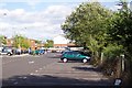
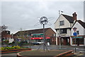
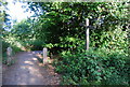
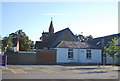
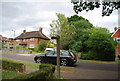
100 photos from this area
Area Information
Key information about the GU6 8SW including its size, population, and administrative classification.
- Area Type
- Postcode
- Area Size
- 1.0 hectares
- Population
- 1733
- Population Density
- 613 people/km²
House Prices in GU6 8SW
25
Properties
£336,273
Average Sold Price
£135,000
Lowest Price
£510,000
Highest Price
Showing 25 properties
| Address | Type | Beds | Baths | Last Sale Price | Last Sale Date | |
|---|---|---|---|---|---|---|
| 4A Rowland Road, Cranleigh, GU6 8SW | Flat | 2 | 1 | £225,000 | Dec 2020 | |
| Victoria Hall, Rowland Road, Cranleigh, GU6 8SW | Detached | 3 | 2 | £510,000 | Oct 2020 | |
| 4B Rowland Road, Cranleigh, GU6 8SW | Flat | - | - | £190,000 | Aug 2020 | |
| Fairhaven, 9 Rowland Road, Cranleigh, GU6 8SW | Semi-detached | 4 | 2 | £475,000 | Jan 2020 | |
| 7 Rowland Road, Cranleigh, GU6 8SW | house | - | - | £494,000 | Dec 2017 | |
| 11 Rowland Road, Cranleigh, GU6 8SW | Semi-detached | 4 | 2 | £450,000 | Dec 2016 | |
| 13 Rowland Road, Cranleigh, GU6 8SW | house | - | - | £487,500 | Oct 2015 | |
| 4 Rowland Road, Cranleigh, GU6 8SW | Flat | - | - | £297,500 | Jul 2010 | |
| 12 Rowland Road, Cranleigh, GU6 8SW | Semi-detached | - | - | £300,000 | May 2006 | |
| 14 Rowland Road, Cranleigh, GU6 8SW | Semi-detached | - | - | £135,000 | Jan 1999 |
Page 1 of 3
Energy Efficiency in GU6 8SW
Amenities
Schools
| Rank | School | Type | Entry gender | Ages |
|---|
Explore more schools in this area
Go to Schools tabDemographics
Household Size
One person
most common
Accommodation Type
Houses
most common
Tenure
61
majority
Ethnic Group
White
most common
Religion
N/A
most common
Household Composition
N/A
most common
Age
47
median
Adults (30-64 years)
most common
Household Deprivation
N/A
with no deprivation
NS-SEC
39
in Lower managerial occupations
Explore more demographic insights in this area
Go to Demographics tabPlanning
Planning Constraints
- Flood RiskPremium
- Ramsar Wetland SitesPremium
- Area of Outstanding Natural BeautyPremium
- Protected Nature ReservePremium
- Protected WoodlandPremium