Area Overview for GU6 8RD
Photos of GU6 8RD
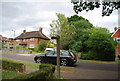
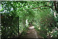
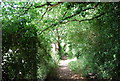
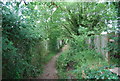
100 photos from this area
Area Information
Key information about the GU6 8RD including its size, population, and administrative classification.
- Area Type
- Postcode
- Area Size
- 7982 m²
- Population
- 1733
- Population Density
- 613 people/km²
House Prices in GU6 8RD
16
Properties
£353,375
Average Sold Price
£246,000
Lowest Price
£530,000
Highest Price
Showing 16 properties
| Address | Type | Beds | Baths | Last Sale Price | Last Sale Date | |
|---|---|---|---|---|---|---|
| Crantock, Knowle Lane, Cranleigh, GU6 8RD | Semi-detached | 2 | 1 | £530,000 | May 2021 | |
| The Firs, Knowle Lane, Cranleigh, GU6 8RD | house | - | - | £329,000 | Jan 2014 | |
| Clovers, Knowle Lane, Cranleigh, GU6 8RD | house | - | - | £246,000 | Jan 2007 | |
| The Cottage, Knowle Lane, Cranleigh, GU6 8RD | Semi-detached | - | - | £308,500 | Feb 2004 | |
| Homeleigh, Knowle Lane, Cranleigh, GU6 8RD | Semi-detached | 2 | 1 | - | - | |
| Flat 1, Rivers Gate House, Knowle Lane, Cranleigh, GU6 8RD | Land | 5 | 5 | - | - | |
| Magnolia Cottage, Knowle Lane, Cranleigh, GU6 8RD | Semi-detached | - | - | - | - | |
| Flat 3, Rivers Gate House, Knowle Lane, Cranleigh, GU6 8RD | Flat | - | - | - | - | |
| Flat 2, Rivers Gate House, Knowle Lane, Cranleigh, GU6 8RD | Flat | - | - | - | - | |
| Flat 4, Rivers Gate House, Knowle Lane, Cranleigh, GU6 8RD | Flat | - | - | - | - |
Page 1 of 2
Energy Efficiency in GU6 8RD
Amenities
Schools
| Rank | School | Type | Entry gender | Ages |
|---|
Explore more schools in this area
Go to Schools tabDemographics
Household Size
One person
most common
Accommodation Type
Houses
most common
Tenure
61
majority
Ethnic Group
White
most common
Religion
N/A
most common
Household Composition
N/A
most common
Age
47
median
Adults (30-64 years)
most common
Household Deprivation
N/A
with no deprivation
NS-SEC
39
in Lower managerial occupations
Explore more demographic insights in this area
Go to Demographics tabPlanning
Planning Constraints
- Flood RiskPremium
- Ramsar Wetland SitesPremium
- Area of Outstanding Natural BeautyPremium
- Protected Nature ReservePremium
- Protected WoodlandPremium