Area Overview for GU6 8PJ
Photos of GU6 8PJ
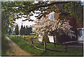
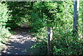
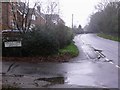
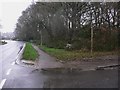
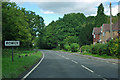
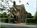
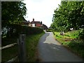
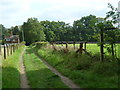

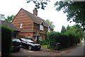
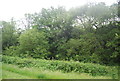
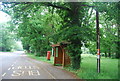
24 photos from this area
Area Information
Key information about the GU6 8PJ including its size, population, and administrative classification.
- Area Type
- Postcode
- Area Size
- 8.6 hectares
- Population
- 1727
- Population Density
- 516 people/km²
House Prices in GU6 8PJ
27
Properties
£606,967
Average Sold Price
£178,000
Lowest Price
£980,000
Highest Price
Showing 27 properties
| Address | Type | Beds | Baths | Last Sale Price | Last Sale Date | |
|---|---|---|---|---|---|---|
| Rhosilli, Rowly Drive, Cranleigh, GU6 8PJ | Detached | 3 | 1 | £640,000 | Sep 2025 | |
| Hazeldene, Rowly Drive, Cranleigh, GU6 8PJ | house | - | - | £500,000 | Dec 2024 | |
| Cloudsley House, Rowly Drive, Cranleigh, GU6 8PJ | house | - | - | £750,000 | Apr 2024 | |
| Aviary Moor, Rowly Drive, Cranleigh, GU6 8PJ | Detached | 4 | 3 | £980,000 | Apr 2024 | |
| Rowly Lodge, Rowly Drive, Cranleigh, GU6 8PJ | Detached | 3 | 1 | £532,500 | Oct 2023 | |
| Oakdene, Rowly Drive, Cranleigh, GU6 8PJ | Detached | 4 | 3 | £785,000 | Mar 2022 | |
| Durdle Dore, Rowly Drive, Cranleigh, GU6 8PJ | Bungalow | 2 | 1 | £750,000 | Mar 2021 | |
| Roswin, Rowly Drive, Cranleigh, GU6 8PJ | Detached | 4 | 2 | £650,000 | Feb 2021 | |
| Harvan, Rowly Drive, Cranleigh, GU6 8PJ | Bungalow | 4 | 2 | £515,000 | Jan 2021 | |
| Hopwoods Cottage, Rowly Drive, Cranleigh, GU6 8PJ | house | - | - | £925,000 | Dec 2020 |
Page 1 of 3
Energy Efficiency in GU6 8PJ
Amenities
Schools
| Rank | School | Type | Entry gender | Ages |
|---|
Explore more schools in this area
Go to Schools tabDemographics
Household Size
Two person
most common
Accommodation Type
Houses
most common
Tenure
79
majority
Ethnic Group
White
most common
Religion
N/A
most common
Household Composition
N/A
most common
Age
47
median
Adults (30-64 years)
most common
Household Deprivation
N/A
with no deprivation
NS-SEC
43
in Lower managerial occupations
Explore more demographic insights in this area
Go to Demographics tabPlanning
Planning Constraints
- Flood RiskPremium
- Ramsar Wetland SitesPremium
- Area of Outstanding Natural BeautyPremium
- Protected Nature ReservePremium
- Protected WoodlandPremium