Area Overview for GU6 8JT
Photos of GU6 8JT
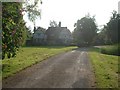
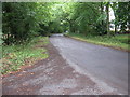
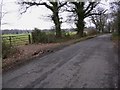
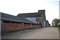
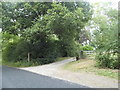
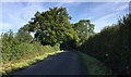
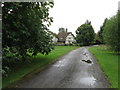
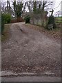
43 photos from this area
Area Information
Key information about the GU6 8JT including its size, population, and administrative classification.
- Area Type
- Postcode
- Area Size
- 1.4 km²
- Population
- 1571
- Population Density
- 244 people/km²
House Prices in GU6 8JT
12
Properties
£1,296,500
Average Sold Price
£677,500
Lowest Price
£2,275,000
Highest Price
Showing 12 properties
| Address | Type | Beds | Baths | Last Sale Price | Last Sale Date | |
|---|---|---|---|---|---|---|
| Great Garson, Alfold Road, Cranleigh, GU6 8JT | Detached | 4 | 4 | £2,275,000 | May 2019 | |
| Fastbridge Cottage, Alfold Road, Cranleigh, GU6 8JT | Detached | 2 | - | £680,000 | Sep 2016 | |
| Little Garson, Alfold Road, Cranleigh, GU6 8JT | Detached | 4 | 3 | £1,750,000 | Mar 2010 | |
| Keepers Mount, Alfold Road, Cranleigh, GU6 8JT | Detached | - | - | £1,100,000 | Oct 2007 | |
| Bettons, Alfold Road, Cranleigh, GU6 8JT | house | - | - | £677,500 | Dec 2006 | |
| Holdhurst Manor, Alfold Road, Cranleigh, GU6 8JT | Detached | 5 | - | - | - | |
| Great Garson Cottage, Alfold Road, Cranleigh, GU6 8JT | Detached | - | - | - | - | |
| HOLDHURST FARM, ALFOLD ROAD, Cranleigh, GU6 8JT | Detached | - | - | - | - | |
| 3, Holdhurst Farm Cottages, Alfold Road, Cranleigh, GU6 8JT | Cottage | 3 | - | - | - | |
| 2, Holdhurst Farm Cottages, Alfold Road, Cranleigh, GU6 8JT | Semi-detached | 3 | 3 | - | - |
Page 1 of 2
Energy Efficiency in GU6 8JT
Amenities
Schools
| Rank | School | Type | Entry gender | Ages |
|---|
Explore more schools in this area
Go to Schools tabDemographics
Household Size
Two person
most common
Accommodation Type
Houses
most common
Tenure
86
majority
Ethnic Group
White
most common
Religion
N/A
most common
Household Composition
N/A
most common
Age
47
median
Adults (30-64 years)
most common
Household Deprivation
N/A
with no deprivation
NS-SEC
50
in Lower managerial occupations
Explore more demographic insights in this area
Go to Demographics tabPlanning
Planning Constraints
- Flood RiskPremium
- Ramsar Wetland SitesPremium
- Area of Outstanding Natural BeautyPremium
- Protected Nature ReservePremium
- Protected WoodlandPremium