Area Overview for GU6 8EZ
Photos of GU6 8EZ

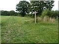
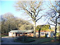
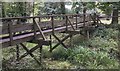
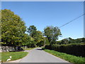
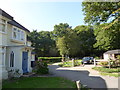
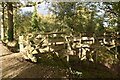
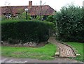
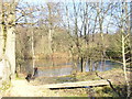
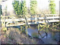
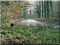
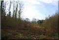
45 photos from this area
Area Information
Key information about the GU6 8EZ including its size, population, and administrative classification.
- Area Type
- Postcode
- Area Size
- 1.2 km²
- Population
- 1968
- Population Density
- 63 people/km²
House Prices in GU6 8EZ
12
Properties
£671,933
Average Sold Price
£358,300
Lowest Price
£1,192,500
Highest Price
Showing 12 properties
| Address | Type | Beds | Baths | Last Sale Price | Last Sale Date | |
|---|---|---|---|---|---|---|
| Sydney Lodge, Rosemary Lane, Alfold, Cranleigh, GU6 8EZ | house | - | - | £1,192,500 | Jan 2024 | |
| Cobweb Cottage, Rosemary Lane, Alfold, Cranleigh, GU6 8EZ | Terraced | 3 | 1 | £358,300 | Oct 2017 | |
| The Old Manor House, Rosemary Lane, Alfold, Cranleigh, GU6 8EZ | house | 4 | 1 | £465,000 | Sep 1995 | |
| Milledge, Rosemary Lane, Alfold, Cranleigh, GU6 8EZ | Detached | 4 | 1 | - | - | |
| The Barn Flat, Maple Farm, Rosemary Lane, Alfold, Cranleigh, GU6 8EZ | Flat | - | - | - | - | |
| The Studio, Maple Farm, Rosemary Lane, Alfold, Cranleigh, GU6 8EZ | Flat | - | - | - | - | |
| Sydney Chase, Rosemary Lane, Alfold, Cranleigh, GU6 8EZ | Farm | - | - | - | - | |
| Sydney Farm, 6 Rosemary Lane, Alfold, Cranleigh, GU6 8EZ | Cottage | 3 | - | - | - | |
| Maple Farm, Rosemary Lane, Alfold, Cranleigh, GU6 8EZ | Terraced | - | - | - | - | |
| Sydney Wood Cottage, Rosemary Lane, Alfold, Cranleigh, GU6 8EZ | house | - | - | - | - |
Page 1 of 2
Energy Efficiency in GU6 8EZ
Amenities
Schools
| Rank | School | Type | Entry gender | Ages |
|---|
Explore more schools in this area
Go to Schools tabDemographics
Household Size
One person
most common
Accommodation Type
Houses
most common
Tenure
76
majority
Ethnic Group
White
most common
Religion
N/A
most common
Household Composition
N/A
most common
Age
47
median
Elderly (65+ years)
most common
Household Deprivation
N/A
with no deprivation
NS-SEC
39
in Lower managerial occupations
Explore more demographic insights in this area
Go to Demographics tabPlanning
Planning Constraints
- Flood RiskPremium
- Ramsar Wetland SitesPremium
- Area of Outstanding Natural BeautyPremium
- Protected Nature ReservePremium
- Protected WoodlandPremium