Area Overview for GU6 8DT
Photos of GU6 8DT
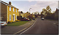

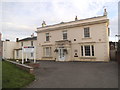
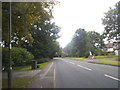
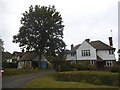
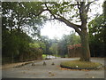
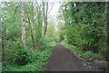
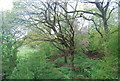
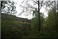
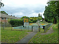

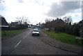
39 photos from this area
Area Information
Key information about the GU6 8DT including its size, population, and administrative classification.
- Area Type
- Postcode
- Area Size
- 1.4 hectares
- Population
- 1418
- Population Density
- 3247 people/km²
House Prices in GU6 8DT
29
Properties
£461,869
Average Sold Price
£190,000
Lowest Price
£1,197,000
Highest Price
Showing 29 properties
| Address | Type | Beds | Baths | Last Sale Price | Last Sale Date | |
|---|---|---|---|---|---|---|
| Glendale, 57 Horsham Road, Cranleigh, GU6 8DT | Detached | 6 | 3 | £1,197,000 | Sep 2025 | |
| The Pines, 41 Horsham Road, Cranleigh, GU6 8DT | Semi-detached | 2 | - | £350,000 | Oct 2018 | |
| Rossmoyne, 31 Horsham Road, Cranleigh, GU6 8DT | Detached | 4 | 2 | £700,000 | Feb 2018 | |
| 27 Horsham Road, Cranleigh, GU6 8DT | Detached | 3 | 2 | £465,000 | Jul 2007 | |
| Beeches, 43 Horsham Road, Cranleigh, GU6 8DT | house | - | - | £190,000 | Apr 2003 | |
| Maudlyn Cottage, 35 Horsham Road, Cranleigh, GU6 8DT | Detached | 3 | 1 | £325,000 | Jan 2002 | |
| The Maples, 39 Horsham Road, Cranleigh, GU6 8DT | Semi-detached | - | - | £229,950 | Jun 2001 | |
| Hazels, 37 Horsham Road, Cranleigh, GU6 8DT | Detached | - | - | £238,000 | Apr 2001 | |
| Flat 2, Coves House, 51 Horsham Road, Cranleigh, GU6 8DT | Flat | 2 | 2 | - | - | |
| Flat 12, Coves House, 51 Horsham Road, Cranleigh, GU6 8DT | Flat | 2 | 2 | - | - |
Page 1 of 3
Energy Efficiency in GU6 8DT
Amenities
Schools
| Rank | School | Type | Entry gender | Ages |
|---|
Explore more schools in this area
Go to Schools tabDemographics
Household Size
Two person
most common
Accommodation Type
Houses
most common
Tenure
77
majority
Ethnic Group
White
most common
Religion
N/A
most common
Household Composition
N/A
most common
Age
47
median
Adults (30-64 years)
most common
Household Deprivation
N/A
with no deprivation
NS-SEC
45
in Lower managerial occupations
Explore more demographic insights in this area
Go to Demographics tabPlanning
Planning Constraints
- Flood RiskPremium
- Ramsar Wetland SitesPremium
- Area of Outstanding Natural BeautyPremium
- Protected Nature ReservePremium
- Protected WoodlandPremium