Area Overview for GU6 7DT
Photos of GU6 7DT
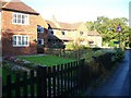
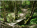


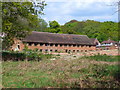
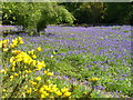
35 photos from this area
Area Information
Key information about the GU6 7DT including its size, population, and administrative classification.
- Area Type
- Postcode
- Area Size
- 18.0 hectares
- Population
- 1600
- Population Density
- 1098 people/km²
House Prices in GU6 7DT
13
Properties
£714,143
Average Sold Price
£270,000
Lowest Price
£1,350,000
Highest Price
Showing 13 properties
| Address | Type | Beds | Baths | Last Sale Price | Last Sale Date | |
|---|---|---|---|---|---|---|
| Cranberries, Wanborough Lane, Cranleigh, GU6 7DT | Detached | 4 | 3 | £1,150,000 | Feb 2025 | |
| Antlers, Wanborough Lane, Cranleigh, GU6 7DT | Detached | 4 | 2 | £600,000 | Dec 2019 | |
| Wanborough House, Wanborough Lane, Cranleigh, GU6 7DT | Detached | 5 | 2 | £1,350,000 | Oct 2019 | |
| Byeways, Wanborough Lane, Cranleigh, GU6 7DT | Detached | 3 | - | £498,000 | Jan 2013 | |
| Oakwood, Wanborough Lane, Cranleigh, GU6 7DT | Detached | 5 | 3 | £720,000 | Sep 2012 | |
| Little Hatch, Wanborough Lane, Cranleigh, GU6 7DT | house | - | - | £411,000 | Sep 2009 | |
| Rosewood House, Wanborough Lane, Cranleigh, GU6 7DT | Detached | 5 | 3 | £270,000 | Oct 1996 | |
| Greyfriars, Wanborough Lane, Cranleigh, GU6 7DT | Detached | 4 | 2 | - | - | |
| Crossways, Wanborough Lane, Cranleigh, GU6 7DT | Detached | 6 | 3 | - | - | |
| Pooh Corner, Wanborough Lane, Cranleigh, GU6 7DT | house | - | - | - | - |
Page 1 of 2
Energy Efficiency in GU6 7DT
Amenities
Schools
| Rank | School | Type | Entry gender | Ages |
|---|
Explore more schools in this area
Go to Schools tabDemographics
Household Size
Two person
most common
Accommodation Type
Houses
most common
Tenure
92
majority
Ethnic Group
White
most common
Religion
N/A
most common
Household Composition
N/A
most common
Age
47
median
Adults (30-64 years)
most common
Household Deprivation
N/A
with no deprivation
NS-SEC
51
in Lower managerial occupations
Explore more demographic insights in this area
Go to Demographics tabPlanning
Planning Constraints
- Flood RiskPremium
- Ramsar Wetland SitesPremium
- Area of Outstanding Natural BeautyPremium
- Protected Nature ReservePremium
- Protected WoodlandPremium