Area Overview for GU52 8AP
Photos of GU52 8AP
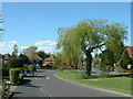
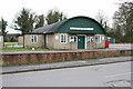
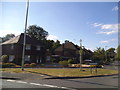
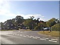


25 photos from this area
Area Information
Key information about the GU52 8AP including its size, population, and administrative classification.
- Area Type
- Postcode
- Area Size
- 1.8 hectares
- Population
- 2305
- Population Density
- 389 people/km²
House Prices in GU52 8AP
84
Properties
£374,683
Average Sold Price
£195,000
Lowest Price
£565,000
Highest Price
Showing 84 properties
| Address | Type | Beds | Baths | Last Sale Price | Last Sale Date | |
|---|---|---|---|---|---|---|
| 101 Jubilee Drive, Church Crookham, Fleet, GU52 8AP | Terraced | 3 | 1 | £340,000 | Apr 2025 | |
| 1, George Court, Jubilee Drive, Church Crookham, Fleet, GU52 8AP | Flat | 1 | 1 | £200,000 | Oct 2024 | |
| 148 Jubilee Drive, Church Crookham, Fleet, GU52 8AP | house | 3 | 2 | £550,000 | Sep 2024 | |
| 3 Lama Place, Church Crookham, Fleet, GU52 8AP | Detached | 3 | 3 | £420,000 | Jul 2024 | |
| 132 Jubilee Drive, Church Crookham, Fleet, GU52 8AP | Terraced | 4 | 2 | £486,000 | Jun 2024 | |
| 146 Jubilee Drive, Church Crookham, Fleet, GU52 8AP | Terraced | 3 | - | £325,000 | Feb 2024 | |
| 116 Jubilee Drive, Church Crookham, Fleet, GU52 8AP | Terraced | 3 | 1 | £325,000 | Dec 2023 | |
| 138 Jubilee Drive, Church Crookham, Fleet, GU52 8AP | Terraced | 3 | 2 | £445,000 | Aug 2023 | |
| 105 Jubilee Drive, Church Crookham, Fleet, GU52 8AP | Semi-detached | 4 | 2 | £485,000 | Apr 2023 | |
| 136 Jubilee Drive, Church Crookham, Fleet, GU52 8AP | Terraced | 3 | - | £435,000 | Aug 2022 |
Page 1 of 9
Energy Efficiency in GU52 8AP
Amenities
Schools
| Rank | School | Type | Entry gender | Ages |
|---|
Explore more schools in this area
Go to Schools tabDemographics
Household Size
Family (3-5 people)
most common
Accommodation Type
Houses
most common
Tenure
63
majority
Ethnic Group
White
most common
Religion
N/A
most common
Household Composition
N/A
most common
Age
47
median
Adults (30-64 years)
most common
Household Deprivation
N/A
with no deprivation
NS-SEC
51
in Lower managerial occupations
Explore more demographic insights in this area
Go to Demographics tabPlanning
Planning Constraints
- Flood RiskPremium
- Ramsar Wetland SitesPremium
- Area of Outstanding Natural BeautyPremium
- Protected Nature ReservePremium
- Protected WoodlandPremium