Area Overview for GU52 7SF
Photos of GU52 7SF
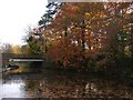
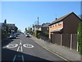
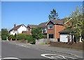
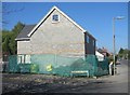
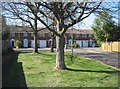
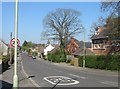
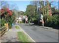
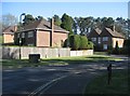
100 photos from this area
Area Information
Key information about the GU52 7SF including its size, population, and administrative classification.
- Area Type
- Postcode
- Area Size
- 2.2 hectares
- Population
- 1564
- Population Density
- 3583 people/km²
House Prices in GU52 7SF
31
Properties
£461,473
Average Sold Price
£282,000
Lowest Price
£800,000
Highest Price
Showing 31 properties
| Address | Type | Beds | Baths | Last Sale Price | Last Sale Date | |
|---|---|---|---|---|---|---|
| 21 Carthona Drive, Fleet, GU52 7SF | Detached | 3 | 2 | £615,000 | Sep 2025 | |
| 20 Carthona Drive, Fleet, GU52 7SF | Detached | 3 | 1 | £610,000 | Jun 2025 | |
| 9 Carthona Drive, Fleet, GU52 7SF | Detached | 4 | 2 | £655,000 | Oct 2024 | |
| 11 Carthona Drive, Fleet, GU52 7SF | Detached | 3 | 1 | £560,000 | Jul 2023 | |
| The Laurels, 2A Carthona Drive, Fleet, GU52 7SF | house | - | - | £800,000 | Sep 2021 | |
| 7 Carthona Drive, Fleet, GU52 7SF | house | - | - | £612,500 | Apr 2021 | |
| 3 Carthona Drive, Fleet, GU52 7SF | Detached | 4 | - | £482,500 | Feb 2015 | |
| 1 Carthona Drive, Fleet, GU52 7SF | Detached | 4 | 1 | £442,500 | Dec 2014 | |
| 5 Carthona Drive, Fleet, GU52 7SF | house | - | - | £475,000 | Jul 2014 | |
| 10 Carthona Drive, Fleet, GU52 7SF | Detached | 4 | 2 | £418,500 | Jul 2012 |
Page 1 of 4
Energy Efficiency in GU52 7SF
Amenities
Schools
| Rank | School | Type | Entry gender | Ages |
|---|
Explore more schools in this area
Go to Schools tabDemographics
Household Size
Family (3-5 people)
most common
Accommodation Type
Houses
most common
Tenure
92
majority
Ethnic Group
White
most common
Religion
N/A
most common
Household Composition
N/A
most common
Age
47
median
Adults (30-64 years)
most common
Household Deprivation
N/A
with no deprivation
NS-SEC
52
in Lower managerial occupations
Explore more demographic insights in this area
Go to Demographics tabPlanning
Planning Constraints
- Flood RiskPremium
- Ramsar Wetland SitesPremium
- Area of Outstanding Natural BeautyPremium
- Protected Nature ReservePremium
- Protected WoodlandPremium