Area Overview for GU52 6LQ
Photos of GU52 6LQ
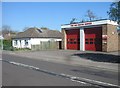
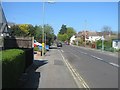
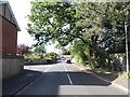
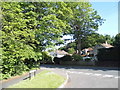
55 photos from this area
Area Information
Key information about the GU52 6LQ including its size, population, and administrative classification.
- Area Type
- Postcode
- Area Size
- 4.8 hectares
- Population
- 1647
- Population Density
- 904 people/km²
House Prices in GU52 6LQ
29
Properties
£415,588
Average Sold Price
£109,000
Lowest Price
£880,000
Highest Price
Showing 29 properties
| Address | Type | Beds | Baths | Last Sale Price | Last Sale Date | |
|---|---|---|---|---|---|---|
| 62 Florence Road, Fleet, GU52 6LQ | Bungalow | 2 | 1 | £642,500 | Sep 2025 | |
| 40 Florence Road, Fleet, GU52 6LQ | Detached | 5 | 3 | £880,000 | Mar 2024 | |
| 44A Florence Road, Fleet, GU52 6LQ | house | 3 | - | £370,000 | Feb 2021 | |
| 34 Florence Road, Fleet, GU52 6LQ | house | - | - | £590,000 | Oct 2020 | |
| 56 Florence Road, Fleet, GU52 6LQ | Bungalow | 4 | 4 | £767,500 | Sep 2020 | |
| 46 Florence Road, Fleet, GU52 6LQ | Terraced | 3 | - | £352,000 | Dec 2019 | |
| Alverstoke, 36B Florence Road, Fleet, GU52 6LQ | Semi-detached | 3 | 2 | £484,000 | Sep 2017 | |
| 22 Florence Road, Fleet, GU52 6LQ | Detached | 4 | - | £592,500 | Jul 2015 | |
| 14 Florence Road, Fleet, GU52 6LQ | house | - | - | £420,000 | Jul 2014 | |
| 60 Florence Road, Fleet, GU52 6LQ | Bungalow | 3 | 2 | £355,000 | Jan 2013 |
Page 1 of 3
Energy Efficiency in GU52 6LQ
Amenities
Schools
| Rank | School | Type | Entry gender | Ages |
|---|
Explore more schools in this area
Go to Schools tabDemographics
Household Size
Family (3-5 people)
most common
Accommodation Type
Houses
most common
Tenure
91
majority
Ethnic Group
White
most common
Religion
N/A
most common
Household Composition
N/A
most common
Age
47
median
Adults (30-64 years)
most common
Household Deprivation
N/A
with no deprivation
NS-SEC
44
in Lower managerial occupations
Explore more demographic insights in this area
Go to Demographics tabPlanning
Planning Constraints
- Flood RiskPremium
- Ramsar Wetland SitesPremium
- Area of Outstanding Natural BeautyPremium
- Protected Nature ReservePremium
- Protected WoodlandPremium