Area Overview for GU51 3PR
Photos of GU51 3PR

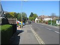
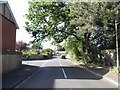
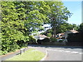
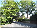
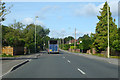
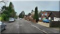
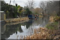
55 photos from this area
Area Information
Key information about the GU51 3PR including its size, population, and administrative classification.
- Area Type
- Postcode
- Area Size
- 5778 m²
- Population
- 1630
- Population Density
- 3759 people/km²
House Prices in GU51 3PR
8
Properties
£458,333
Average Sold Price
£250,000
Lowest Price
£730,000
Highest Price
Showing 8 properties
| Address | Type | Beds | Baths | Last Sale Price | Last Sale Date | |
|---|---|---|---|---|---|---|
| 31 Albany Road, Fleet, GU51 3PR | Detached | 4 | 2 | £730,000 | Apr 2025 | |
| 33 Albany Road, Fleet, GU51 3PR | Bungalow | 3 | - | £395,000 | May 2013 | |
| 27 Albany Road, Fleet, GU51 3PR | Detached | - | - | £250,000 | Jan 2002 | |
| 27A Albany Road, Fleet, GU51 3PR | Detached | 4 | - | - | - | |
| Oakley Park Pavilion, Albany Road, Fleet, GU51 3PR | Leisure | - | - | - | - | |
| 27B Albany Road, Fleet, GU51 3PR | Detached | - | - | - | - | |
| 35 Albany Road, Fleet, GU51 3PR | Detached | - | - | - | - | |
| 29 Albany Road, Fleet, GU51 3PR | Detached | - | - | - | - |
Energy Efficiency in GU51 3PR
Amenities
Schools
| Rank | School | Type | Entry gender | Ages |
|---|
Explore more schools in this area
Go to Schools tabDemographics
Household Size
Family (3-5 people)
most common
Accommodation Type
Houses
most common
Tenure
93
majority
Ethnic Group
White
most common
Religion
N/A
most common
Household Composition
N/A
most common
Age
47
median
Adults (30-64 years)
most common
Household Deprivation
N/A
with no deprivation
NS-SEC
50
in Lower managerial occupations
Explore more demographic insights in this area
Go to Demographics tabPlanning
Planning Constraints
- Flood RiskPremium
- Ramsar Wetland SitesPremium
- Area of Outstanding Natural BeautyPremium
- Protected Nature ReservePremium
- Protected WoodlandPremium