Area Overview for GU51 3BU
Photos of GU51 3BU


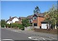
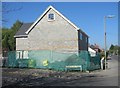
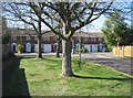
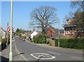
100 photos from this area
Area Information
Key information about the GU51 3BU including its size, population, and administrative classification.
- Area Type
- Postcode
- Area Size
- 5790 m²
- Population
- 2236
- Population Density
- 4996 people/km²
House Prices in GU51 3BU
12
Properties
-
Average Sold Price
-
Lowest Price
-
Highest Price
Showing 12 properties
| Address | Type | Beds | Baths | Last Sale Price | Last Sale Date | |
|---|---|---|---|---|---|---|
| Living Accommodation, 333A Fleet Road, Fleet, GU51 3BU | Flat | - | - | - | - | |
| 325B Fleet Road, Fleet, GU51 3BU | Flat | - | - | - | - | |
| 325A Fleet Road, Fleet, GU51 3BU | Flat | - | - | - | - | |
| 315A Fleet Road, Fleet, GU51 3BU | Flat | - | - | - | - | |
| 325C Fleet Road, Fleet, GU51 3BU | Flat | - | - | - | - | |
| Living Accommodation, 327 Fleet Road, Fleet, GU51 3BU | Terraced | - | - | - | - | |
| Living Accommodation, 317 Fleet Road, Fleet, GU51 3BU | Flat | - | - | - | - | |
| Saturday Market, Gurka Square Car Park, Fleet Road, Fleet, GU51 3BU | Retail | - | - | - | - | |
| 333A Fleet Road, Fleet, GU51 3BU | retail_financial | - | - | - | - | |
| We, 333 Fleet Road, Fleet, GU51 3BU | restaurant_cafe | - | - | - | - |
Page 1 of 2
Energy Efficiency in GU51 3BU
Amenities
Schools
| Rank | School | Type | Entry gender | Ages |
|---|
Explore more schools in this area
Go to Schools tabDemographics
Household Size
One person
most common
Accommodation Type
Flats
most common
Tenure
60
majority
Ethnic Group
White
most common
Religion
N/A
most common
Household Composition
N/A
most common
Age
47
median
Adults (30-64 years)
most common
Household Deprivation
N/A
with no deprivation
NS-SEC
45
in Lower managerial occupations
Explore more demographic insights in this area
Go to Demographics tabPlanning
Planning Constraints
- Flood RiskPremium
- Ramsar Wetland SitesPremium
- Area of Outstanding Natural BeautyPremium
- Protected Nature ReservePremium
- Protected WoodlandPremium