Area Overview for GU5 9QE
Photos of GU5 9QE
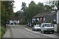
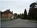
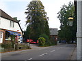
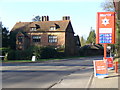
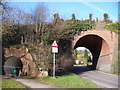
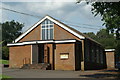
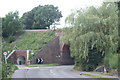
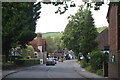
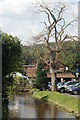
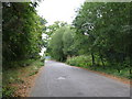
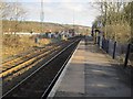
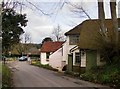
100 photos from this area
Area Information
Key information about the GU5 9QE including its size, population, and administrative classification.
- Area Type
- Postcode
- Area Size
- 22.5 hectares
- Population
- 1997
- Population Density
- 154 people/km²
House Prices in GU5 9QE
40
Properties
£814,684
Average Sold Price
£100,000
Lowest Price
£3,250,000
Highest Price
Showing 40 properties
| Address | Type | Beds | Baths | Last Sale Price | Last Sale Date | |
|---|---|---|---|---|---|---|
| Cherry Hill, Burrows Lane, Gomshall, GU5 9QE | Detached | 6 | 2 | £2,250,000 | Jun 2023 | |
| Whispering Oaks, Burrows Lane, Gomshall, GU5 9QE | Detached | 4 | 3 | £1,750,000 | Apr 2023 | |
| Somersbury House, Burrows Lane, Gomshall, GU5 9QE | house | - | - | £3,250,000 | Oct 2022 | |
| Cobwebs, Burrows Lane, Gomshall, GU5 9QE | Detached | 3 | 2 | £670,000 | Apr 2020 | |
| Sandwood, Burrows Lane, Gomshall, GU5 9QE | house | 5 | 3 | £800,000 | Aug 2015 | |
| Garden Cottage, Burrows Lane, Gomshall, GU5 9QE | Detached | 3 | - | £830,000 | Apr 2014 | |
| Sheer View, Burrows Lane, Gomshall, GU5 9QE | Bungalow | 4 | - | £575,000 | Feb 2012 | |
| Glenholme, Burrows Lane, Gomshall, GU5 9QE | Detached | 5 | 3 | £365,000 | Dec 2006 | |
| Brambletye, Burrows Lane, Gomshall, GU5 9QE | Flat | 2 | 1 | £705,000 | Oct 2006 | |
| Mill Cottage, Burrows Lane, Gomshall, GU5 9QE | Detached | - | - | £342,000 | May 2005 |
Page 1 of 4
Energy Efficiency in GU5 9QE
Amenities
Schools
| Rank | School | Type | Entry gender | Ages |
|---|
Explore more schools in this area
Go to Schools tabDemographics
Household Size
Two person
most common
Accommodation Type
Houses
most common
Tenure
88
majority
Ethnic Group
White
most common
Religion
N/A
most common
Household Composition
N/A
most common
Age
47
median
Adults (30-64 years)
most common
Household Deprivation
N/A
with no deprivation
NS-SEC
53
in Lower managerial occupations
Explore more demographic insights in this area
Go to Demographics tabPlanning
Planning Constraints
- Flood RiskPremium
- Ramsar Wetland SitesPremium
- Area of Outstanding Natural BeautyPremium
- Protected Nature ReservePremium
- Protected WoodlandPremium