Area Overview for GU5 9NZ
Photos of GU5 9NZ
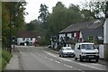
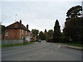
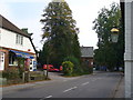
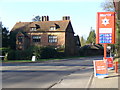
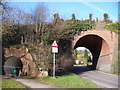
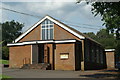
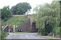
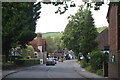
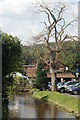
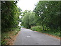
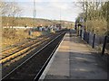
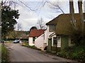
100 photos from this area
Area Information
Key information about the GU5 9NZ including its size, population, and administrative classification.
- Area Type
- Postcode
- Area Size
- 54.5 hectares
- Population
- 1997
- Population Density
- 154 people/km²
House Prices in GU5 9NZ
26
Properties
£779,384
Average Sold Price
£450,000
Lowest Price
£1,400,000
Highest Price
Showing 26 properties
| Address | Type | Beds | Baths | Last Sale Price | Last Sale Date | |
|---|---|---|---|---|---|---|
| Holly Cottage, Wonham Way, Gomshall, GU5 9NZ | Detached | 5 | 3 | £1,400,000 | Sep 2023 | |
| Restharrow, Wonham Way, Gomshall, GU5 9NZ | house | - | - | £1,400,000 | Jul 2019 | |
| Brackenhurst, Wonham Way, Gomshall, GU5 9NZ | Detached | 3 | 2 | £815,000 | May 2018 | |
| Highfields, Wonham Way, Gomshall, GU5 9NZ | Detached | 5 | 2 | £1,075,000 | Jan 2016 | |
| Bargate, Wonham Way, Gomshall, GU5 9NZ | Detached | 4 | - | £760,000 | Aug 2015 | |
| Southbrook Copse, Wonham Way, Gomshall, GU5 9NZ | Detached | 3 | 1 | £777,256 | Apr 2014 | |
| Pippins, Wonham Way, Gomshall, GU5 9NZ | Detached | 4 | 2 | £647,500 | Apr 2014 | |
| Linden Lea, Wonham Way, Gomshall, GU5 9NZ | Bungalow | 4 | - | £630,000 | Sep 2012 | |
| Twiga Lodge, Wonham Way, Gomshall, GU5 9NZ | house | - | - | £496,000 | Mar 2012 | |
| Broadview Cottage, Wonham Way, Gomshall, GU5 9NZ | Bungalow | 3 | - | £672,500 | Sep 2011 |
Page 1 of 3
Energy Efficiency in GU5 9NZ
Amenities
Schools
| Rank | School | Type | Entry gender | Ages |
|---|
Explore more schools in this area
Go to Schools tabDemographics
Household Size
Two person
most common
Accommodation Type
Houses
most common
Tenure
88
majority
Ethnic Group
White
most common
Religion
N/A
most common
Household Composition
N/A
most common
Age
47
median
Adults (30-64 years)
most common
Household Deprivation
N/A
with no deprivation
NS-SEC
53
in Lower managerial occupations
Explore more demographic insights in this area
Go to Demographics tabPlanning
Planning Constraints
- Flood RiskPremium
- Ramsar Wetland SitesPremium
- Area of Outstanding Natural BeautyPremium
- Protected Nature ReservePremium
- Protected WoodlandPremium