Area Overview for GU5 9HG
Photos of GU5 9HG
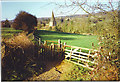
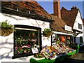
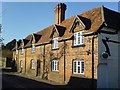
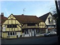
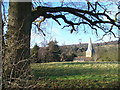
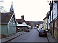
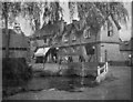
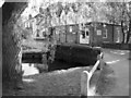
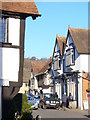
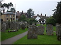
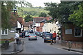
100 photos from this area
Area Information
Key information about the GU5 9HG including its size, population, and administrative classification.
- Area Type
- Postcode
- Area Size
- 6414 m²
- Population
- 2003
- Population Density
- 125 people/km²
House Prices in GU5 9HG
16
Properties
£718,143
Average Sold Price
£210,000
Lowest Price
£1,560,000
Highest Price
Showing 16 properties
| Address | Type | Beds | Baths | Last Sale Price | Last Sale Date | |
|---|---|---|---|---|---|---|
| Pantrys, The Square, Shere, GU5 9HG | Semi-detached | 4 | 1 | £1,000,000 | Jun 2021 | |
| Haven Cottage, The Square, Shere, GU5 9HG | Cottage | 2 | 2 | £545,000 | Jan 2021 | |
| Sayers, The Square, Shere, GU5 9HG | Detached | - | - | £1,560,000 | Jun 2017 | |
| Vaughans, The Square, Shere, GU5 9HG | Detached | 4 | 2 | £750,000 | Nov 2013 | |
| The Cottage, The Square, Shere, GU5 9HG | Terraced | 3 | 1 | £432,000 | Nov 2006 | |
| Stream Cottage, The Square, Shere, GU5 9HG | Terraced | - | - | £530,000 | Jul 2006 | |
| Barn Cottage, 1 The Square, Shere, GU5 9HG | Terraced | - | - | £210,000 | Sep 1997 | |
| 2 The Square, Shere, GU5 9HG | Terraced | 3 | 1 | - | - | |
| 5 The Square, Shere, GU5 9HG | Semi-detached | 3 | 1 | - | - | |
| Pitts, Pitts Workshop, Vaughans, The Square, Shere, GU5 9HG | Industrial | - | - | - | - |
Page 1 of 2
Energy Efficiency in GU5 9HG
Amenities
Schools
| Rank | School | Type | Entry gender | Ages |
|---|
Explore more schools in this area
Go to Schools tabDemographics
Household Size
Two person
most common
Accommodation Type
Houses
most common
Tenure
60
majority
Ethnic Group
White
most common
Religion
N/A
most common
Household Composition
N/A
most common
Age
47
median
Adults (30-64 years)
most common
Household Deprivation
N/A
with no deprivation
NS-SEC
44
in Lower managerial occupations
Explore more demographic insights in this area
Go to Demographics tabPlanning
Planning Constraints
- Flood RiskPremium
- Ramsar Wetland SitesPremium
- Area of Outstanding Natural BeautyPremium
- Protected Nature ReservePremium
- Protected WoodlandPremium