Area Overview for GU47 9AU
Photos of GU47 9AU
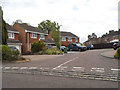
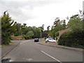
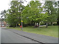
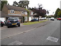
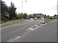
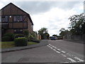
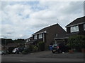
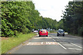
46 photos from this area
Area Information
Key information about the GU47 9AU including its size, population, and administrative classification.
- Area Type
- Postcode
- Area Size
- 5.4 hectares
- Population
- 1243
- Population Density
- 1206 people/km²
House Prices in GU47 9AU
43
Properties
£613,469
Average Sold Price
£184,000
Lowest Price
£1,200,000
Highest Price
Showing 43 properties
| Address | Type | Beds | Baths | Last Sale Price | Last Sale Date | |
|---|---|---|---|---|---|---|
| Chesterwood, 11 Robin Lane, Sandhurst, GU47 9AU | Detached | 4 | 2 | £800,000 | Jun 2025 | |
| 3 Robin Lane, Sandhurst, GU47 9AU | Semi-detached | 5 | 2 | £875,000 | Oct 2024 | |
| 47 Robin Lane, Sandhurst, GU47 9AU | Detached | 4 | 2 | £720,000 | Apr 2024 | |
| 25 Robin Lane, Sandhurst, GU47 9AU | Detached | 4 | 2 | £890,000 | Dec 2022 | |
| 16 Robin Lane, Sandhurst, GU47 9AU | Retail | 6 | 3 | £875,000 | Feb 2022 | |
| 10 Robin Lane, Sandhurst, GU47 9AU | house | - | - | £950,000 | Dec 2021 | |
| 31 Robin Lane, Sandhurst, GU47 9AU | Detached | 5 | 2 | £915,000 | Oct 2021 | |
| 6 Robin Lane, Sandhurst, GU47 9AU | house | - | - | £635,000 | May 2021 | |
| 29 Robin Lane, Sandhurst, GU47 9AU | Detached | 5 | 3 | £1,200,000 | Sep 2018 | |
| 66 Robin Lane, Sandhurst, GU47 9AU | Detached | 5 | - | £835,000 | Jul 2017 |
Page 1 of 5
Energy Efficiency in GU47 9AU
Amenities
Schools
| Rank | School | Type | Entry gender | Ages |
|---|
Explore more schools in this area
Go to Schools tabDemographics
Household Size
Two person
most common
Accommodation Type
Houses
most common
Tenure
95
majority
Ethnic Group
White
most common
Religion
N/A
most common
Household Composition
N/A
most common
Age
47
median
Adults (30-64 years)
most common
Household Deprivation
N/A
with no deprivation
NS-SEC
49
in Lower managerial occupations
Explore more demographic insights in this area
Go to Demographics tabPlanning
Planning Constraints
- Flood RiskPremium
- Ramsar Wetland SitesPremium
- Area of Outstanding Natural BeautyPremium
- Protected Nature ReservePremium
- Protected WoodlandPremium