Area Overview for GU4 8EX
Photos of GU4 8EX
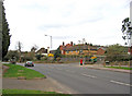
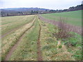
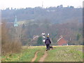
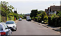
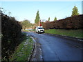
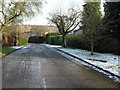
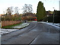
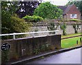
100 photos from this area
Area Information
Key information about the GU4 8EX including its size, population, and administrative classification.
- Area Type
- Postcode
- Area Size
- 2.1 hectares
- Population
- 1857
- Population Density
- 1862 people/km²
House Prices in GU4 8EX
30
Properties
£428,091
Average Sold Price
£119,000
Lowest Price
£725,000
Highest Price
Showing 30 properties
| Address | Type | Beds | Baths | Last Sale Price | Last Sale Date | |
|---|---|---|---|---|---|---|
| 82 Tillingbourne Road, Shalford, GU4 8EX | Maisonette | 2 | 1 | £291,000 | Sep 2023 | |
| 44 Tillingbourne Road, Shalford, GU4 8EX | Semi-detached | 3 | 1 | £686,000 | Mar 2021 | |
| 46 Tillingbourne Road, Shalford, GU4 8EX | house | - | - | £725,000 | Feb 2018 | |
| 78A Tillingbourne Road, Shalford, GU4 8EX | Flat | - | - | £281,000 | Oct 2017 | |
| 68 Tillingbourne Road, Shalford, GU4 8EX | Semi-detached | 4 | 2 | £600,000 | Feb 2017 | |
| 52 Tillingbourne Road, Shalford, GU4 8EX | house | 4 | - | £545,000 | May 2010 | |
| 56 Tillingbourne Road, Shalford, GU4 8EX | house | 3 | - | £359,000 | Mar 2005 | |
| 50 Tillingbourne Road, Shalford, GU4 8EX | Semi-detached | - | - | £349,000 | Jan 2005 | |
| 66 Tillingbourne Road, Shalford, GU4 8EX | house | - | - | £425,000 | Oct 2002 | |
| 60 Tillingbourne Road, Shalford, GU4 8EX | Detached | 3 | - | £329,000 | Sep 2001 |
Page 1 of 3
Energy Efficiency in GU4 8EX
Amenities
Schools
| Rank | School | Type | Entry gender | Ages |
|---|
Explore more schools in this area
Go to Schools tabDemographics
Household Size
Family (3-5 people)
most common
Accommodation Type
Houses
most common
Tenure
66
majority
Ethnic Group
White
most common
Religion
N/A
most common
Household Composition
N/A
most common
Age
47
median
Adults (30-64 years)
most common
Household Deprivation
N/A
with no deprivation
NS-SEC
44
in Lower managerial occupations
Explore more demographic insights in this area
Go to Demographics tabPlanning
Planning Constraints
- Flood RiskPremium
- Ramsar Wetland SitesPremium
- Area of Outstanding Natural BeautyPremium
- Protected Nature ReservePremium
- Protected WoodlandPremium