Area Overview for GU35 9PY
Photos of GU35 9PY
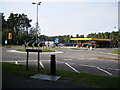
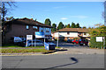
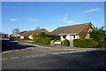


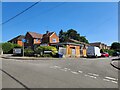


19 photos from this area
Area Information
Key information about the GU35 9PY including its size, population, and administrative classification.
- Area Type
- Postcode
- Area Size
- 2.4 hectares
- Population
- 1255
- Population Density
- 6078 people/km²
House Prices in GU35 9PY
64
Properties
£183,256
Average Sold Price
£24,500
Lowest Price
£430,000
Highest Price
Showing 64 properties
| Address | Type | Beds | Baths | Last Sale Price | Last Sale Date | |
|---|---|---|---|---|---|---|
| 16 Dudley Close, Whitehill, Bordon, GU35 9PY | Bungalow | - | - | £300,000 | Nov 2025 | |
| 21 Dudley Close, Whitehill, Bordon, GU35 9PY | Semi-detached | 2 | 1 | £262,500 | Dec 2024 | |
| 27 Dudley Close, Whitehill, Bordon, GU35 9PY | Detached | 3 | 1 | £310,000 | Sep 2024 | |
| 63 Dudley Close, Whitehill, Bordon, GU35 9PY | Semi-detached | 1 | 1 | £240,000 | May 2024 | |
| 49 Dudley Close, Whitehill, Bordon, GU35 9PY | Semi-detached | 1 | 1 | £204,000 | Feb 2024 | |
| 64 Dudley Close, Whitehill, Bordon, GU35 9PY | Semi-detached | 1 | 1 | £207,500 | Jan 2024 | |
| 44 Dudley Close, Whitehill, Bordon, GU35 9PY | Maisonette | 1 | 1 | £150,000 | Oct 2022 | |
| 2 Dudley Close, Whitehill, Bordon, GU35 9PY | Retail | 4 | 1 | £430,000 | Jul 2022 | |
| 17 Dudley Close, Whitehill, Bordon, GU35 9PY | Bungalow | - | - | £315,000 | Dec 2021 | |
| 60 Dudley Close, Whitehill, Bordon, GU35 9PY | Bungalow | - | - | £286,000 | Dec 2021 |
Page 1 of 7
Energy Efficiency in GU35 9PY
Amenities
Schools
| Rank | School | Type | Entry gender | Ages |
|---|
Explore more schools in this area
Go to Schools tabDemographics
Household Size
Family (3-5 people)
most common
Accommodation Type
Houses
most common
Tenure
73
majority
Ethnic Group
White
most common
Religion
N/A
most common
Household Composition
N/A
most common
Age
47
median
Adults (30-64 years)
most common
Household Deprivation
N/A
with no deprivation
NS-SEC
31
in Lower managerial occupations
Explore more demographic insights in this area
Go to Demographics tabPlanning
Planning Constraints
- Flood RiskPremium
- Ramsar Wetland SitesPremium
- Area of Outstanding Natural BeautyPremium
- Protected Nature ReservePremium
- Protected WoodlandPremium