Area Overview for GU35 9DY
Photos of GU35 9DY
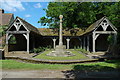
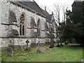

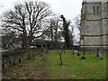


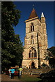


58 photos from this area
Area Information
Key information about the GU35 9DY including its size, population, and administrative classification.
- Area Type
- Postcode
- Area Size
- 7.1 hectares
- Population
- 1782
- Population Density
- 342 people/km²
House Prices in GU35 9DY
14
Properties
£356,900
Average Sold Price
£110,000
Lowest Price
£575,000
Highest Price
Showing 14 properties
| Address | Type | Beds | Baths | Last Sale Price | Last Sale Date | |
|---|---|---|---|---|---|---|
| Hausklein, Firgrove Road, Whitehill, Bordon, GU35 9DY | Bungalow | 3 | 1 | £440,000 | Aug 2024 | |
| Charanne, Firgrove Road, Whitehill, Bordon, GU35 9DY | Bungalow | 4 | 2 | £575,000 | Sep 2022 | |
| Sharjah, Firgrove Road, Whitehill, Bordon, GU35 9DY | Bungalow | 4 | 1 | £400,000 | Sep 2018 | |
| Fairways, Firgrove Road, Whitehill, Bordon, GU35 9DY | Detached | 4 | 2 | £420,000 | Jun 2018 | |
| Farthings, Firgrove Road, Whitehill, Bordon, GU35 9DY | house | - | - | £525,000 | Jun 2015 | |
| Two Magpies, Firgrove Road, Whitehill, Bordon, GU35 9DY | Bungalow | 4 | - | £332,000 | Mar 2013 | |
| Redwood, Firgrove Road, Whitehill, Bordon, GU35 9DY | Bungalow | 3 | 2 | £325,000 | Feb 2013 | |
| Pax, Firgrove Road, Whitehill, Bordon, GU35 9DY | Bungalow | - | - | £244,000 | Aug 2011 | |
| Shannon, Firgrove Road, Whitehill, Bordon, GU35 9DY | Detached | - | - | £198,000 | Mar 2001 | |
| Bedean, Firgrove Road, Whitehill, Bordon, GU35 9DY | Detached | 5 | - | £110,000 | Jul 1996 |
Page 1 of 2
Energy Efficiency in GU35 9DY
Amenities
Schools
| Rank | School | Type | Entry gender | Ages |
|---|
Explore more schools in this area
Go to Schools tabDemographics
Household Size
Two person
most common
Accommodation Type
Houses
most common
Tenure
71
majority
Ethnic Group
White
most common
Religion
N/A
most common
Household Composition
N/A
most common
Age
47
median
Adults (30-64 years)
most common
Household Deprivation
N/A
with no deprivation
NS-SEC
34
in Lower managerial occupations
Explore more demographic insights in this area
Go to Demographics tabPlanning
Planning Constraints
- Flood RiskPremium
- Ramsar Wetland SitesPremium
- Area of Outstanding Natural BeautyPremium
- Protected Nature ReservePremium
- Protected WoodlandPremium