Area Overview for GU35 8HA
Photos of GU35 8HA
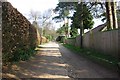
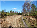
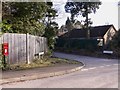
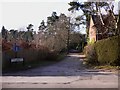
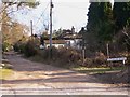
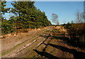
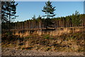
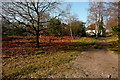
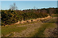

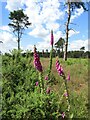
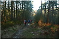
14 photos from this area
Area Information
Key information about the GU35 8HA including its size, population, and administrative classification.
- Area Type
- Postcode
- Area Size
- 27.2 hectares
- Population
- 2094
- Population Density
- 132 people/km²
House Prices in GU35 8HA
25
Properties
£552,125
Average Sold Price
£89,000
Lowest Price
£872,500
Highest Price
Showing 25 properties
| Address | Type | Beds | Baths | Last Sale Price | Last Sale Date | |
|---|---|---|---|---|---|---|
| 54A Furze Hill Road, Headley, Bordon, GU35 8HA | Detached | 4 | 2 | £872,500 | Jul 2024 | |
| Shammah, 63A Furze Hill Road, Headley, Bordon, GU35 8HA | Detached | 3 | 2 | £835,000 | Sep 2023 | |
| Whincanton, 53 Furze Hill Road, Headley, Bordon, GU35 8HA | house | - | - | £835,000 | Jun 2021 | |
| Ferndale, 48 Furze Hill Road, Headley, Bordon, GU35 8HA | Detached | 4 | 2 | £650,000 | Jan 2019 | |
| 65 Furze Hill Road, Headley, Bordon, GU35 8HA | Detached | 4 | 2 | £645,000 | Dec 2018 | |
| 57 Furze Hill Road, Headley, Bordon, GU35 8HA | house | - | - | £750,000 | Sep 2016 | |
| Mulberry, 55 Furze Hill Road, Headley, Bordon, GU35 8HA | Detached | 5 | 3 | £757,500 | May 2016 | |
| 63 Furze Hill Road, Headley, Bordon, GU35 8HA | house | 4 | - | £740,000 | Dec 2015 | |
| St Louis, 50 Furze Hill Road, Headley, Bordon, GU35 8HA | Semi-detached | 3 | - | £472,000 | Aug 2014 | |
| Kentmere, 44 Furze Hill Road, Headley, Bordon, GU35 8HA | Detached | 5 | 2 | £551,000 | May 2014 |
Page 1 of 3
Energy Efficiency in GU35 8HA
Amenities
Schools
| Rank | School | Type | Entry gender | Ages |
|---|
Explore more schools in this area
Go to Schools tabDemographics
Household Size
Family (3-5 people)
most common
Accommodation Type
Houses
most common
Tenure
85
majority
Ethnic Group
White
most common
Religion
N/A
most common
Household Composition
N/A
most common
Age
47
median
Adults (30-64 years)
most common
Household Deprivation
N/A
with no deprivation
NS-SEC
49
in Lower managerial occupations
Explore more demographic insights in this area
Go to Demographics tabPlanning
Planning Constraints
- Flood RiskPremium
- Ramsar Wetland SitesPremium
- Area of Outstanding Natural BeautyPremium
- Protected Nature ReservePremium
- Protected WoodlandPremium