Area Overview for GU35 0SW
Photos of GU35 0SW
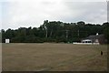

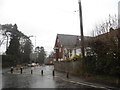
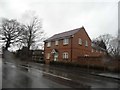


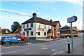

67 photos from this area
Area Information
Key information about the GU35 0SW including its size, population, and administrative classification.
- Area Type
- Postcode
- Area Size
- 1.4 hectares
- Population
- 2739
- Population Density
- 3489 people/km²
House Prices in GU35 0SW
23
Properties
£347,000
Average Sold Price
£88,000
Lowest Price
£770,000
Highest Price
Showing 23 properties
| Address | Type | Beds | Baths | Last Sale Price | Last Sale Date | |
|---|---|---|---|---|---|---|
| Merlewood, 19 Taylors Lane, Lindford, Bordon, GU35 0SW | Detached | 5 | 2 | £770,000 | Sep 2024 | |
| 27 Taylors Lane, Lindford, Bordon, GU35 0SW | house | 3 | 2 | £400,000 | May 2022 | |
| Sami Anja, 21 Taylors Lane, Lindford, Bordon, GU35 0SW | house | - | - | £355,000 | Nov 2019 | |
| Bicclescombe, 17 Taylors Lane, Lindford, Bordon, GU35 0SW | Bungalow | 2 | 1 | £335,000 | Jan 2019 | |
| May Dew, 8 Taylors Lane, Lindford, Bordon, GU35 0SW | Detached | 3 | 1 | £414,000 | Mar 2017 | |
| Old Farm Cottage, 14 Taylors Lane, Lindford, Bordon, GU35 0SW | Detached | 4 | - | £575,000 | Mar 2017 | |
| The Cedars, 22 Taylors Lane, Lindford, Bordon, GU35 0SW | Detached | 4 | 3 | £570,000 | Feb 2017 | |
| 28 Taylors Lane, Lindford, Bordon, GU35 0SW | house | - | - | £335,000 | Aug 2016 | |
| 26 Taylors Lane, Lindford, Bordon, GU35 0SW | Bungalow | 2 | 1 | £337,500 | Mar 2016 | |
| Fremont, 23 Taylors Lane, Lindford, Bordon, GU35 0SW | house | - | - | £275,000 | Aug 2015 |
Page 1 of 3
Energy Efficiency in GU35 0SW
Amenities
Schools
| Rank | School | Type | Entry gender | Ages |
|---|
Explore more schools in this area
Go to Schools tabDemographics
Household Size
Two person
most common
Accommodation Type
Houses
most common
Tenure
77
majority
Ethnic Group
White
most common
Religion
N/A
most common
Household Composition
N/A
most common
Age
47
median
Adults (30-64 years)
most common
Household Deprivation
N/A
with no deprivation
NS-SEC
36
in Lower managerial occupations
Explore more demographic insights in this area
Go to Demographics tabPlanning
Planning Constraints
- Flood RiskPremium
- Ramsar Wetland SitesPremium
- Area of Outstanding Natural BeautyPremium
- Protected Nature ReservePremium
- Protected WoodlandPremium