Area Overview for GU34 5HH
Photos of GU34 5HH
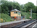
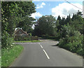
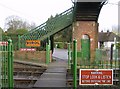
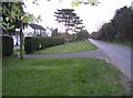
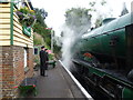
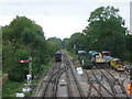
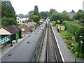
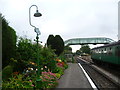
100 photos from this area
Area Information
Key information about the GU34 5HH including its size, population, and administrative classification.
- Area Type
- Postcode
- Area Size
- 6717 m²
- Population
- 1953
- Population Density
- 1010 people/km²
House Prices in GU34 5HH
9
Properties
£214,167
Average Sold Price
£67,500
Lowest Price
£377,500
Highest Price
Showing 9 properties
| Address | Type | Beds | Baths | Last Sale Price | Last Sale Date | |
|---|---|---|---|---|---|---|
| Cranford, Station Approach, Four Marks, Alton, GU34 5HH | Bungalow | - | - | £370,000 | Apr 2011 | |
| The Approach, Station Approach, Four Marks, Alton, GU34 5HH | Detached | - | - | £377,500 | Jun 2008 | |
| Wodehouse, Station Approach, Four Marks, Alton, GU34 5HH | Detached | - | - | £295,000 | Mar 2006 | |
| 3 Station Approach, Four Marks, Alton, GU34 5HH | Semi-detached | - | - | £67,500 | Feb 1997 | |
| Orchardene, Station Approach, Four Marks, Alton, GU34 5HH | Detached | - | - | £105,000 | Jan 1997 | |
| 2 Station Approach, Four Marks, Alton, GU34 5HH | Semi-detached | - | - | £70,000 | Apr 1996 | |
| Police House, 1 Station Approach, Four Marks, Alton, GU34 5HH | house | - | - | - | - | |
| 4 Station Approach, Four Marks, Alton, GU34 5HH | house | - | - | - | - | |
| Prospects, Station Approach, Four Marks, Alton, GU34 5HH | Detached | - | - | - | - |
Energy Efficiency in GU34 5HH
Amenities
Schools
| Rank | School | Type | Entry gender | Ages |
|---|
Explore more schools in this area
Go to Schools tabDemographics
Household Size
Two person
most common
Accommodation Type
Houses
most common
Tenure
79
majority
Ethnic Group
White
most common
Religion
N/A
most common
Household Composition
N/A
most common
Age
47
median
Adults (30-64 years)
most common
Household Deprivation
N/A
with no deprivation
NS-SEC
43
in Lower managerial occupations
Explore more demographic insights in this area
Go to Demographics tabPlanning
Planning Constraints
- Flood RiskPremium
- Ramsar Wetland SitesPremium
- Area of Outstanding Natural BeautyPremium
- Protected Nature ReservePremium
- Protected WoodlandPremium