Area Overview for GU34 5DG
Photos of GU34 5DG
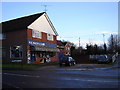
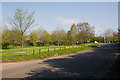


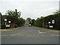
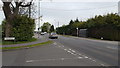
33 photos from this area
Area Information
Key information about the GU34 5DG including its size, population, and administrative classification.
- Area Type
- Postcode
- Area Size
- 3.8 hectares
- Population
- 1423
- Population Density
- 344 people/km²
House Prices in GU34 5DG
18
Properties
£486,372
Average Sold Price
£119,950
Lowest Price
£850,000
Highest Price
Showing 18 properties
| Address | Type | Beds | Baths | Last Sale Price | Last Sale Date | |
|---|---|---|---|---|---|---|
| 74 Blackberry Lane, Four Marks, Alton, GU34 5DG | Detached | 3 | 2 | £700,000 | Jan 2025 | |
| 68 Blackberry Lane, Four Marks, Alton, GU34 5DG | Semi-detached | 4 | 2 | £641,000 | Aug 2023 | |
| Oakwood Cottage, 72 Blackberry Lane, Four Marks, Alton, GU34 5DG | house | 4 | 1 | £610,000 | Oct 2022 | |
| 70 Blackberry Lane, Four Marks, Alton, GU34 5DG | Semi-detached | 4 | 1 | £585,000 | Jan 2022 | |
| 83 Blackberry Lane, Four Marks, Alton, GU34 5DG | Detached | 4 | 2 | £450,000 | Sep 2021 | |
| Gorath, 78 Blackberry Lane, Four Marks, Alton, GU34 5DG | Bungalow | - | - | £470,000 | Jun 2017 | |
| Perivale House, 77 Blackberry Lane, Four Marks, Alton, GU34 5DG | house | 5 | 3 | £830,000 | Feb 2017 | |
| 80 Blackberry Lane, Four Marks, Alton, GU34 5DG | Detached | 5 | 2 | £530,000 | Apr 2015 | |
| 81 Blackberry Lane, Four Marks, Alton, GU34 5DG | house | - | - | £850,000 | Aug 2014 | |
| Rosedle, 91 Blackberry Lane, Four Marks, Alton, GU34 5DG | Detached | 5 | 4 | £400,000 | Sep 2012 |
Page 1 of 2
Energy Efficiency in GU34 5DG
Amenities
Schools
| Rank | School | Type | Entry gender | Ages |
|---|
Explore more schools in this area
Go to Schools tabDemographics
Household Size
Two person
most common
Accommodation Type
Houses
most common
Tenure
94
majority
Ethnic Group
White
most common
Religion
N/A
most common
Household Composition
N/A
most common
Age
47
median
Adults (30-64 years)
most common
Household Deprivation
N/A
with no deprivation
NS-SEC
45
in Lower managerial occupations
Explore more demographic insights in this area
Go to Demographics tabPlanning
Planning Constraints
- Flood RiskPremium
- Ramsar Wetland SitesPremium
- Area of Outstanding Natural BeautyPremium
- Protected Nature ReservePremium
- Protected WoodlandPremium