Area Overview for GU34 4JB
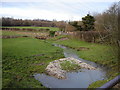
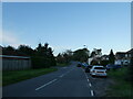
Photos of GU34 4JB


Area Information
GU34 4JB is a small, low-density residential postcode in England, home to 1394 residents spread across a modest area. This is a quiet, compact community where daily life revolves around local amenities and a relaxed pace. The area’s sparse population and open spaces suggest a focus on private living rather than high-density urban living. With a median age of 47, it is predominantly inhabited by adults aged 30–64, many of whom own their homes. The presence of nearby rail stations, including Alton and Bentley, and retail outlets like Lidl Alton and Spar, ensures basic needs are met without the need to travel far. While the area lacks major urban hubs, its proximity to RAF Odiham and Lasham Airport hints at a connection to regional infrastructure. For those seeking a peaceful, self-contained lifestyle with minimal commuting, GU34 4JB offers a distinct contrast to busier centres, though its limited amenities mean residents must balance convenience with the charm of a smaller, more insular community.
- Area Type
- Postcode
- Area Size
- Not available
- Population
- 1394
- Population Density
- 40 people/km²
GU34 4JB is a predominantly owner-occupied area, with 76% of properties owned by their residents. The housing stock consists entirely of houses, reflecting a lack of high-density or mixed-use developments. This makes the area distinct from larger towns or cities where flats and apartments are more common. The low population density of 40 people per square kilometre suggests spacious, individual properties with private gardens, appealing to those prioritising privacy and space. However, the limited number of homes—given the small population—means the market is likely small and niche. Buyers should consider that the area’s remoteness and limited amenities may restrict its appeal to those requiring proximity to major services or employment hubs. For those seeking a quiet, self-contained home with minimal neighbours, the property market here offers a unique proposition, though it may not suit those needing frequent access to urban centres.
House Prices in GU34 4JB
No properties found in this postcode.
Energy Efficiency in GU34 4JB
Living in GU34 4JB offers access to a selection of local shops and services within practical reach. Retail options include Spar, Lidl Alton, and Aldi Alton, providing essentials for daily living. The area’s two rail stations—Alton and Bentley—offer connections to nearby towns, while nearby RAF Odiham and Lasham Airport suggest some regional transport links, though these are not civilian hubs. The absence of major leisure or entertainment venues means the lifestyle here is subdued, focusing on practicality over convenience. Residents must travel further for dining, cultural activities, or larger retail centres. However, the low population density and quiet environment may appeal to those prioritising peace and space over urban vibrancy. The limited amenities reflect the area’s small scale, requiring a balance between self-sufficiency and the need to travel for more specialised services.
Amenities
Schools
| Rank | School | Type | Entry gender | Ages |
|---|
Explore more schools in this area
Go to Schools tabDemographics
The population of GU34 4JB is predominantly adults aged 30–64, reflecting a mature, stable community. With 76% of homes owned by residents, this is a largely owner-occupied area, suggesting long-term residency and investment in local property. The accommodation type is exclusively houses, indicating a lack of flats or apartments, which aligns with the low population density of 40 people per square kilometre. The predominant ethnic group is White, and no data indicates significant diversity beyond this. The median age of 47 suggests a community with a strong presence of middle-aged individuals, likely with established careers and families. This demographic profile implies a focus on stability and long-term living rather than transient populations. The absence of specific deprivation data means quality of life assessments must rely on the available metrics, such as low crime rates and safe environments, which contribute to a sense of security for residents.
Household Size
Accommodation Type
Tenure
Ethnic Group
Religion
Household Composition
Age
Household Deprivation
NS-SEC
Explore more demographic insights in this area
Go to Demographics tabPlanning
Planning Constraints
- Flood RiskPremium
- Ramsar Wetland SitesPremium
- Area of Outstanding Natural BeautyPremium
- Protected Nature ReservePremium
- Protected WoodlandPremium