Area Overview for GU34 4BL
Photos of GU34 4BL
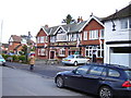
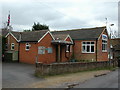
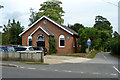
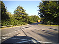
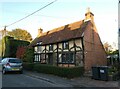
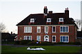
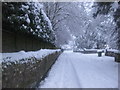
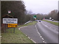
23 photos from this area
Area Information
Key information about the GU34 4BL including its size, population, and administrative classification.
- Area Type
- Postcode
- Area Size
- 3.3 hectares
- Population
- 2112
- Population Density
- 694 people/km²
House Prices in GU34 4BL
73
Properties
£229,658
Average Sold Price
£82,000
Lowest Price
£490,000
Highest Price
Showing 73 properties
| Address | Type | Beds | Baths | Last Sale Price | Last Sale Date | |
|---|---|---|---|---|---|---|
| 37 Garstons Way, Holybourne, Alton, GU34 4BL | Semi-detached | 3 | 1 | £385,000 | Mar 2025 | |
| 43 Garstons Way, Holybourne, Alton, GU34 4BL | Flat | - | - | £114,400 | Aug 2024 | |
| 93 Garstons Way, Holybourne, Alton, GU34 4BL | Flat | - | - | £216,000 | Nov 2022 | |
| 29 Garstons Way, Holybourne, Alton, GU34 4BL | Terraced | 3 | 1 | £360,000 | May 2022 | |
| 105 Garstons Way, Holybourne, Alton, GU34 4BL | Flat | 2 | 1 | £202,000 | Jan 2022 | |
| 95 Garstons Way, Holybourne, Alton, GU34 4BL | Flat | 2 | - | £202,500 | Dec 2021 | |
| 81 Garstons Way, Holybourne, Alton, GU34 4BL | Flat | 2 | 1 | £192,500 | Oct 2021 | |
| 87 Garstons Way, Holybourne, Alton, GU34 4BL | Flat | 2 | 1 | £205,000 | Jul 2021 | |
| 97 Garstons Way, Holybourne, Alton, GU34 4BL | Flat | 2 | 1 | £197,000 | Jun 2021 | |
| 5 Garstons Way, Holybourne, Alton, GU34 4BL | Detached | 3 | 3 | £325,000 | Apr 2021 |
Page 1 of 8
Energy Efficiency in GU34 4BL
Amenities
Schools
| Rank | School | Type | Entry gender | Ages |
|---|
Explore more schools in this area
Go to Schools tabDemographics
Household Size
Two person
most common
Accommodation Type
Houses
most common
Tenure
77
majority
Ethnic Group
White
most common
Religion
N/A
most common
Household Composition
N/A
most common
Age
47
median
Adults (30-64 years)
most common
Household Deprivation
N/A
with no deprivation
NS-SEC
45
in Lower managerial occupations
Explore more demographic insights in this area
Go to Demographics tabPlanning
Planning Constraints
- Flood RiskPremium
- Ramsar Wetland SitesPremium
- Area of Outstanding Natural BeautyPremium
- Protected Nature ReservePremium
- Protected WoodlandPremium