Area Overview for GU34 2YY
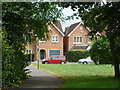
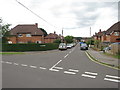
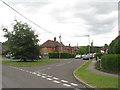
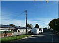
Photos of GU34 2YY


Area Information
Living in GU34 2YY offers a compact, residential experience within a small cluster of homes. The area covers 535 square metres and is home to 2,359 residents, creating a densely populated yet intimate community. With a population density of 855 people per square kilometre, this postcode area is ideal for those seeking proximity to amenities without the sprawl of larger towns. The median age of 47 suggests a mature demographic, with the majority of residents falling between 30 and 64 years old. This age group often prioritises stability, reflected in the 75% home ownership rate, which indicates a strong presence of long-term residents. The area’s character is defined by its mix of local shops, transport links, and nearby natural spaces, though its small size means residents must balance convenience with limited expansion. For buyers, GU34 2YY presents a blend of practicality and community focus, with homes primarily in single-family structures. However, the high flood risk score of 100 highlights a critical environmental challenge that potential buyers must consider alongside the area’s other advantages.
- Area Type
- Postcode
- Area Size
- 535 m²
- Population
- 2359
- Population Density
- 855 people/km²
The property market in GU34 2YY is dominated by owner-occupied homes, with 75% of residents living in properties they own. This high home ownership rate indicates a stable market with limited rental activity, suggesting that buyers may find fewer short-term lettings and more long-term investments. The accommodation type is primarily houses, which are typically larger and suited to families or those requiring more space. This contrasts with areas where flats or apartments dominate, making GU34 2YY a niche choice for those prioritising single-family homes. The small size of the postcode area means the housing stock is limited, so buyers may need to consider nearby regions for additional options. However, the concentration of houses in this area could appeal to those seeking a traditional, settled lifestyle. Given the high flood risk, property buyers should also conduct thorough environmental assessments to ensure their investment aligns with their long-term needs.
House Prices in GU34 2YY
No properties found in this postcode.
Energy Efficiency in GU34 2YY
Residents of GU34 2YY have access to a range of amenities within walking or short driving distance. The retail sector includes Aldi Alton, Lidl Alton, and Waitrose Alton, providing everyday shopping options. These stores cater to both basic needs and more specialised purchases, enhancing convenience. The area’s proximity to railway stations and airports ensures easy access to regional and national travel. While there is no mention of parks or leisure facilities in the data, the presence of multiple transport links suggests a balance between urban and semi-rural living. The compact nature of the area means amenities are clustered closely, reducing the need for long commutes. For those prioritising convenience, the mix of retail and transport options makes GU34 2YY a practical choice, though further exploration may be needed to identify recreational or green spaces.
Amenities
Schools
The nearest school to GU34 2YY is Eastbrook Education Trust, which is categorised as an 'other' type. No specific Ofsted rating is provided in the data, so its performance cannot be evaluated here. The presence of a single school type suggests limited variety for families, though the proximity of the school to the area may be a key factor for parents. For those prioritising a range of educational options, the lack of additional schools nearby could be a consideration. The school’s type and location may influence the overall appeal of the area for families, but further details about its curriculum, size, or facilities are not available. Buyers should verify the school’s standing independently to gauge whether it meets their child’s educational needs.
| Rank | School | Type | Entry gender | Ages |
|---|
Explore more schools in this area
Go to Schools tabDemographics
The community in GU34 2YY is predominantly composed of adults aged 30 to 64, with a median age of 47. This suggests a settled population, likely with established careers and families. Home ownership is high at 75%, indicating a strong preference for long-term residency over rental properties. The area is characterised by houses rather than flats, aligning with the demographic’s likely need for family-friendly living spaces. The predominant ethnic group is White, though no specific diversity statistics are provided. The absence of detailed deprivation data means the quality of life cannot be fully assessed, but the low crime risk score of 82 implies a generally safe environment. The population density of 855 people per square kilometre creates a close-knit community, though it may also contribute to a sense of limited space. For those considering relocation, the age profile and ownership rates suggest a stable, mature neighbourhood with a focus on continuity over rapid change.
Household Size
Accommodation Type
Tenure
Ethnic Group
Religion
Household Composition
Age
Household Deprivation
NS-SEC
Explore more demographic insights in this area
Go to Demographics tabPlanning
Planning Constraints
- Flood RiskPremium
- Ramsar Wetland SitesPremium
- Area of Outstanding Natural BeautyPremium
- Protected Nature ReservePremium
- Protected WoodlandPremium