Area Overview for GU34 2XP
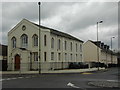
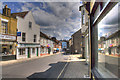
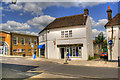
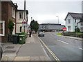
Photos of GU34 2XP


Area Information
GU34 2XP is a small, tightly knit residential postcode area in England, home to 1562 residents. Its compact nature means it functions as a cohesive cluster of homes, with a strong emphasis on private ownership. The area’s demographic profile suggests a mature community, with a median age of 47 and the majority of residents falling within the 30-64 age range. This reflects a stable, family-oriented environment, supported by nearby primary schools and a range of local amenities. Daily life here is characterised by proximity to essential services, including retail outlets like Waitrose Alton and Tesco Alton, as well as rail links to Alton and Bentley stations. The area’s low crime risk score of 70 and excellent broadband connectivity of 99 make it appealing for those prioritising safety and digital reliability. While the postcode itself is small, its strategic location near Alton and surrounding towns ensures access to broader regional opportunities. For buyers, GU34 2XP offers a blend of residential tranquillity and practical connectivity, ideal for those seeking a balanced lifestyle.
- Area Type
- Postcode
- Area Size
- Not available
- Population
- 1562
- Population Density
- 4881 people/km²
The property market in GU34 2XP is characterised by a high proportion of owner-occupied homes, with 61% of residents living in properties they own. The accommodation type is predominantly houses, which is typical of smaller, residential postcode areas. This suggests a market skewed towards private buyers rather than renters, though the exact rental availability is not specified. The small size of the postcode means the housing stock is limited, likely comprising a mix of semi-detached and detached homes. Buyers should consider the proximity to amenities like schools and retail, which enhance the area’s appeal. The focus on owner-occupation and house-based properties indicates a preference for long-term investment over short-term rental opportunities. Those seeking a quiet, family-friendly environment with established housing may find this area particularly attractive.
House Prices in GU34 2XP
No properties found in this postcode.
Energy Efficiency in GU34 2XP
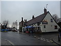
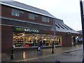
The lifestyle in GU34 2XP is shaped by its proximity to a range of amenities within practical reach. Retail options include major stores like Waitrose Alton, Tesco Alton, and The Southern Co-operative, ensuring access to groceries and everyday essentials. The area’s rail links to Alton and Bentley stations provide easy access to larger towns, while Medstead & Four Marks metro station offers additional transport flexibility. Nearby airports, such as Lasham Airport and RAF Odiham, cater to regional travel needs. Though the postcode itself is small, its location near Alton ensures residents can enjoy a balance of local convenience and regional connectivity. The availability of schools, shops, and transport options contributes to a practical, family-friendly lifestyle without the need for long commutes.
Amenities
Schools
Residents of GU34 2XP have access to three nearby schools, catering to early years and primary education. Alton Infant School and Anstey Junior School both hold a 'good' Ofsted rating, providing a reliable foundation for young learners. Bushy Leaze Early Years Centre offers nursery provision, ensuring continuity of care for younger children. The presence of two primary schools within the area reduces the need for long commutes, making it convenient for families. However, no secondary schools are listed in the data, so parents may need to look further afield for secondary education. The mix of school types suggests a focus on early and primary education, which aligns with the area’s demographic profile of established families.
| Rank | School | Type | Entry gender | Ages |
|---|---|---|---|---|
| 1 | Alton Infant School | primary | N/A | N/A |
| 2 | Anstey Junior School | primary | N/A | N/A |
| 3 | Bushy Leaze Early Years Centre | nursery | N/A | N/A |
Explore more schools in this area
Go to Schools tabDemographics
The population of GU34 2XP is predominantly adults aged 30-64, with a median age of 47. This suggests a community of established professionals and families, rather than a younger or elderly demographic. Home ownership is strong, with 61% of residents living in properties they own, and the accommodation type is primarily houses, indicating a preference for larger, private residences. The predominant ethnic group is White, though no specific data on diversity or deprivation is provided. The absence of detailed diversity metrics means the area’s cultural composition remains unspecified. The age range and home ownership figures imply a relatively stable, long-term resident base, with fewer transient populations. For buyers, this demographic profile suggests a community with low turnover and a focus on family-oriented living.
Household Size
Accommodation Type
Tenure
Ethnic Group
Religion
Household Composition
Age
Household Deprivation
NS-SEC
Explore more demographic insights in this area
Go to Demographics tabPlanning
Planning Constraints
- Flood RiskPremium
- Ramsar Wetland SitesPremium
- Area of Outstanding Natural BeautyPremium
- Protected Nature ReservePremium
- Protected WoodlandPremium
- Crime RiskPremium