Area Overview for GU34 2WG
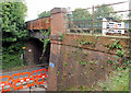
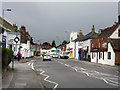
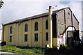
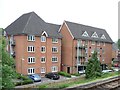
Photos of GU34 2WG


Area Information
GU34 2WG is a small, residential postcode area in England, home to around 1,562 people. This compact cluster of homes is typical of a quiet, low-density neighbourhood, where the majority of residents are adults aged 30 to 64. The area’s character is defined by its proximity to local amenities and transport links, making it a practical choice for those seeking a balance between convenience and tranquillity. With a population that is predominantly White and a strong sense of community, GU34 2WG offers a straightforward lifestyle. Residents benefit from nearby primary schools, retail outlets, and rail services, which connect them to larger towns like Alton and Bentley. The area’s low crime risk and excellent broadband connectivity further enhance its appeal, supporting both daily living and remote work. While it is not a high-rise or densely populated region, its small size ensures a close-knit environment where familiarity with local services is common. For buyers, this area represents a stable, family-friendly option with minimal environmental constraints and a focus on private ownership.
- Area Type
- Postcode
- Area Size
- Not available
- Population
- 1562
- Population Density
- 4881 people/km²
GU34 2WG is primarily an owner-occupied area, with 61% of residents owning their homes. The accommodation type is predominantly houses, which is typical for smaller, rural or semi-rural postcode areas. This suggests a housing stock that is largely single-family homes, offering privacy and space. Given the area’s small size, the property market is likely limited to a handful of listings, but the high home ownership rate indicates a stable demand for local properties. Buyers should consider that the area is not a rental hotspot, which may appeal to those seeking long-term investment or a place to settle. The absence of high-rise or apartment blocks means the housing is likely to be more traditional in style, with gardens or outdoor space. For those prioritising private ownership over rental flexibility, GU34 2WG offers a straightforward, low-maintenance option.
House Prices in GU34 2WG
No properties found in this postcode.
Energy Efficiency in GU34 2WG
Living in GU34 2WG offers access to a range of amenities within practical reach. Retail options include major supermarkets such as Waitrose Alton, Aldi Alton, and Tesco Alton, ensuring convenience for grocery shopping. The area’s rail links to Alton and Bentley stations provide easy access to larger towns, while nearby airports cater to those needing air travel. The Medstead & Four Marks metro station adds to the connectivity. While the data does not specify parks or leisure facilities, the presence of schools and retail hubs suggests a lifestyle focused on practicality and family needs. The combination of local shops, transport links, and nearby airports makes daily life efficient, with minimal need to travel far for essentials.
Amenities
Schools
Residents of GU34 2WG have access to a range of local schools. Alton Infant School and Anstey Junior School both offer primary education and hold a ‘good’ Ofsted rating, indicating reliable standards for early and primary education. The Bushy Leaze Early Years Centre provides nursery care, supporting families with young children. The combination of primary and nursery provision means families can access education from early years through to primary school without leaving the area. This cluster of schools is particularly beneficial for parents seeking continuity in their children’s education. The ‘good’ Ofsted ratings suggest that these institutions meet or exceed national benchmarks, which is a key consideration for families prioritising academic outcomes and school quality.
| Rank | School | Type | Entry gender | Ages |
|---|
Explore more schools in this area
Go to Schools tabDemographics
The population of GU34 2WG is 1,562, with a median age of 47. The majority of residents fall within the 30-64 age range, indicating a community of working-age adults and families. Home ownership is high, with 61% of properties occupied by their owners, suggesting a stable housing market. The predominant accommodation type is houses, which aligns with the area’s low-density layout. The primary ethnic group is White, and no specific data on diversity or deprivation is provided. The age profile implies a mature demographic, which may influence local services and amenities. With no indication of high deprivation levels, the area appears to support a quality of life characterised by stability and access to essential services. This demographic profile suggests a community focused on long-term living rather than transient populations.
Household Size
Accommodation Type
Tenure
Ethnic Group
Religion
Household Composition
Age
Household Deprivation
NS-SEC
Explore more demographic insights in this area
Go to Demographics tabPlanning
Planning Constraints
- Flood RiskPremium
- Ramsar Wetland SitesPremium
- Area of Outstanding Natural BeautyPremium
- Protected Nature ReservePremium
- Protected WoodlandPremium