Area Overview for GU34 2SR
Photos of GU34 2SR
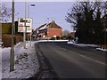
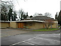
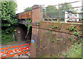
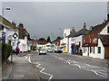


100 photos from this area
Area Information
Key information about the GU34 2SR including its size, population, and administrative classification.
- Area Type
- Postcode
- Area Size
- 6354 m²
- Population
- 2359
- Population Density
- 855 people/km²
House Prices in GU34 2SR
10
Properties
£264,344
Average Sold Price
£93,375
Lowest Price
£378,000
Highest Price
Showing 10 properties
| Address | Type | Beds | Baths | Last Sale Price | Last Sale Date | |
|---|---|---|---|---|---|---|
| Kiln Cottage, 11 Wilsom Road, Alton, GU34 2SR | house | 3 | 1 | £378,000 | Nov 2016 | |
| Two Kiln Cottages, 15 Wilsom Road, Alton, GU34 2SR | Cottage | 3 | - | £338,000 | Apr 2015 | |
| Kilnsyde, 5 Wilsom Road, Alton, GU34 2SR | Detached | - | - | £248,000 | Jul 2006 | |
| Mayland, 3 Wilsom Road, Alton, GU34 2SR | Detached | 4 | 2 | £93,375 | Nov 1996 | |
| Kilnsyde, Wilsom Road, Alton, GU34 2SR | Detached | - | - | - | - | |
| Mayland, Wilsom Road, Alton, GU34 2SR | Detached | - | - | - | - | |
| Alton Tool & Bolt Co, 2 Wilsom Road, Alton, GU34 2SR | Industrial | - | - | - | - | |
| Copplestones, 10 Wilsom Road, Alton, GU34 2SR | Detached | - | - | - | - | |
| Penkenna, 1 Wilsom Road, Alton, GU34 2SR | Detached | - | - | - | - | |
| Pendorrie, 8 Wilsom Road, Alton, GU34 2SR | house | - | - | - | - |
Energy Efficiency in GU34 2SR
Amenities
Schools
| Rank | School | Type | Entry gender | Ages |
|---|
Explore more schools in this area
Go to Schools tabDemographics
Household Size
Two person
most common
Accommodation Type
Houses
most common
Tenure
75
majority
Ethnic Group
White
most common
Religion
N/A
most common
Household Composition
N/A
most common
Age
47
median
Adults (30-64 years)
most common
Household Deprivation
N/A
with no deprivation
NS-SEC
44
in Lower managerial occupations
Explore more demographic insights in this area
Go to Demographics tabPlanning
Planning Constraints
- Flood RiskPremium
- Ramsar Wetland SitesPremium
- Area of Outstanding Natural BeautyPremium
- Protected Nature ReservePremium
- Protected WoodlandPremium