Area Overview for GU34 2JD
Photos of GU34 2JD
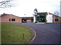

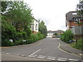
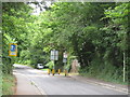
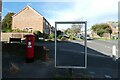

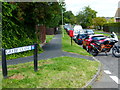
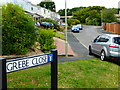
14 photos from this area
Area Information
Key information about the GU34 2JD including its size, population, and administrative classification.
- Area Type
- Postcode
- Area Size
- 1.3 hectares
- Population
- 1209
- Population Density
- 4443 people/km²
House Prices in GU34 2JD
27
Properties
£261,843
Average Sold Price
£98,000
Lowest Price
£435,000
Highest Price
Showing 27 properties
| Address | Type | Beds | Baths | Last Sale Price | Last Sale Date | |
|---|---|---|---|---|---|---|
| 3 Heron Close, Alton, GU34 2JD | Detached | 3 | 1 | £380,000 | Jun 2024 | |
| 22 Heron Close, Alton, GU34 2JD | house | - | - | £320,000 | Mar 2024 | |
| 20 Heron Close, Alton, GU34 2JD | house | - | - | £435,000 | Feb 2021 | |
| 1 Heron Close, Alton, GU34 2JD | house | - | - | £320,975 | Oct 2020 | |
| 34 Heron Close, Alton, GU34 2JD | Semi-detached | 3 | 1 | £262,500 | Aug 2020 | |
| 7 Heron Close, Alton, GU34 2JD | Semi-detached | 3 | 1 | £315,000 | Dec 2018 | |
| 5 Heron Close, Alton, GU34 2JD | house | - | - | £235,000 | Nov 2013 | |
| 17 Heron Close, Alton, GU34 2JD | house | - | - | £297,000 | Sep 2013 | |
| 24 Heron Close, Alton, GU34 2JD | house | 3 | - | £240,000 | Jul 2012 | |
| 2 Heron Close, Alton, GU34 2JD | house | - | - | £250,000 | Nov 2007 |
Page 1 of 3
Energy Efficiency in GU34 2JD
Amenities
Schools
| Rank | School | Type | Entry gender | Ages |
|---|
Explore more schools in this area
Go to Schools tabDemographics
Household Size
Two person
most common
Accommodation Type
Houses
most common
Tenure
82
majority
Ethnic Group
White
most common
Religion
N/A
most common
Household Composition
N/A
most common
Age
47
median
Adults (30-64 years)
most common
Household Deprivation
N/A
with no deprivation
NS-SEC
39
in Lower managerial occupations
Explore more demographic insights in this area
Go to Demographics tabPlanning
Planning Constraints
- Flood RiskPremium
- Ramsar Wetland SitesPremium
- Area of Outstanding Natural BeautyPremium
- Protected Nature ReservePremium
- Protected WoodlandPremium