Area Overview for GU34 2BN
Photos of GU34 2BN
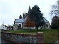
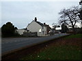
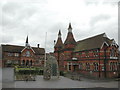
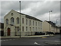
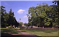
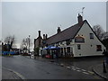
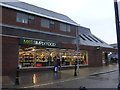
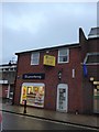
99 photos from this area
Area Information
Key information about the GU34 2BN including its size, population, and administrative classification.
- Area Type
- Postcode
- Area Size
- 4941 m²
- Population
- 1448
- Population Density
- 3274 people/km²
House Prices in GU34 2BN
13
Properties
£242,700
Average Sold Price
£94,000
Lowest Price
£420,000
Highest Price
Showing 13 properties
| Address | Type | Beds | Baths | Last Sale Price | Last Sale Date | |
|---|---|---|---|---|---|---|
| 2 Oliver Rise, Alton, GU34 2BN | house | - | - | £420,000 | Sep 2021 | |
| 10 Oliver Rise, Alton, GU34 2BN | Terraced | 3 | - | £375,000 | Mar 2017 | |
| Cromwell House, 11 Oliver Rise, Alton, GU34 2BN | Terraced | 3 | 2 | £389,000 | Aug 2016 | |
| 4 Oliver Rise, Alton, GU34 2BN | Semi-detached | 3 | 1 | £250,000 | Jun 2013 | |
| 1 Oliver Rise, Alton, GU34 2BN | Terraced | 3 | 2 | £250,000 | Aug 2006 | |
| 5 Oliver Rise, Alton, GU34 2BN | Terraced | - | - | £225,500 | May 2002 | |
| 8 Oliver Rise, Alton, GU34 2BN | Terraced | - | - | £180,000 | Jul 2000 | |
| 7 Oliver Rise, Alton, GU34 2BN | Terraced | - | - | £125,000 | Dec 1998 | |
| 12 Oliver Rise, Alton, GU34 2BN | Terraced | - | - | £118,500 | Aug 1998 | |
| 9 Oliver Rise, Alton, GU34 2BN | Terraced | - | - | £94,000 | May 1996 |
Page 1 of 2
Energy Efficiency in GU34 2BN
Amenities
Schools
| Rank | School | Type | Entry gender | Ages |
|---|
Explore more schools in this area
Go to Schools tabDemographics
Household Size
One person
most common
Accommodation Type
Houses
most common
Tenure
76
majority
Ethnic Group
White
most common
Religion
N/A
most common
Household Composition
N/A
most common
Age
47
median
Adults (30-64 years)
most common
Household Deprivation
N/A
with no deprivation
NS-SEC
43
in Lower managerial occupations
Explore more demographic insights in this area
Go to Demographics tabPlanning
Planning Constraints
- Flood RiskPremium
- Ramsar Wetland SitesPremium
- Area of Outstanding Natural BeautyPremium
- Protected Nature ReservePremium
- Protected WoodlandPremium